|
search place name
|
||
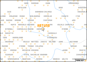
Matuna (Eastern, Zambia)Matuna is a town in the Eastern region of Zambia. An overview map of the region around Matuna is displayed below.
regional and 3d topo map of Matuna, Zambia ::
Matuna airports ::
The nearest airport is MFU - Mfuwe, located 121.6 km north east of Matuna.
Nearby towns ::
Kapiri (1.8km west) //
Kalimbalimbali (1.8km west) //
Chawala (1.9km south) //
Chilawila (1.8km east) //
Mulimbo (1.8km east) //
Kachusi (2.6km north west) //
Kambaumbali (2.6km south west) //
Six Malima (2.6km south east) //
Nyamalopa (2.6km north east) //
Nkundye (2.6km south east) //
Kayawa (4.0km north west) //
Chimtanda (4.1km north east) //
Chimakula (4.0km south east) //
Katota (5.2km north west) //
Nyakawendi (5.2km south east) //
Zakeyo (5.6km south) //
Ndombi (5.4km west) //
Kachapa (5.7km west) //
Joziele Mkonka (5.8km south) //
Kampalwe (5.8km north) //
Matthew (6.6km south west) //
Kapandula (6.6km north west) //
Nkolowondo (6.6km north west) //
Mzomwa (6.5km north west) //
Malimba (6.6km south east) //
Mafumba (6.6km south east) //
Mwamba (7.2km west) //
Kalaile (7.4km east) //
Chandema (7.4km west) //
[all distances 'as the bird flies' and approximate]  Places with similar names to Matuna, Zambia ::
Disclaimer :: Information on this page comes without warranty of any kind |
||
|
Where is Matuna? Elevation and coordinates ::
Latitude (lat): 14°15'0"S Longitude (lon): 31°27'0"E
Elevation (approx.): 1035m (map arrows pan, magnifying glasses zoom) |
||
|
Visiting Matuna? Hotel/Accommodation ::
Book a hotel in Matuna Travel Guide ::
Buy a travel guide for Zambia rental cars ::
car rental offers GPS waypoint ::
download a GPX waypoint (PoI) of Matuna for your GPS receiver
|
||