|
search place name
|
||
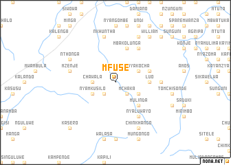
Mfuse (Eastern, Zambia)Mfuse is a town in the Eastern region of Zambia. An overview map of the region around Mfuse is displayed below.
regional and 3d topo map of Mfuse, Zambia ::
Mfuse airports ::
The nearest airport is MFU - Mfuwe, located 152.1 km north east of Mfuse.
Nearby towns ::
Katanda (2.6km south west) //
Mchaka (2.6km south east) //
Chawala (3.6km west) //
Nyamkusilo (4.0km south west) //
Kasonde (4.0km south east) //
Nyakocha (4.0km north east) //
Chinthengu (4.0km south east) //
Mbirizi (4.0km south east) //
Mulinda (5.2km south east) //
Luo (5.4km east) //
Malamba (5.7km east) //
Mbakolunga (5.8km north) //
Makomba (6.6km north east) //
Nyaluwayo (6.6km south east) //
Chinkumba (7.2km east) //
Mzenje (7.4km west) //
Nkhuntha (7.6km north) //
Nthonga (8.1km north west) //
Mwanza (8.1km north west) //
Mankomba (8.2km north east) //
Chinkhango (8.2km south east) //
Chisonso (9.2km north east) //
William (9.2km north east) //
Kasero (10.3km south west) //
Kombalanga (10.3km north east) //
Nyaluwilo (10.3km north east) //
[all distances 'as the bird flies' and approximate]  Places with similar names to Mfuse, Zambia ::
Disclaimer :: Information on this page comes without warranty of any kind |
||
|
Where is Mfuse? Elevation and coordinates ::
Latitude (lat): 14°27'0"S Longitude (lon): 31°14'0"E
Elevation (approx.): 986m (map arrows pan, magnifying glasses zoom) |
||
|
Visiting Mfuse? Hotel/Accommodation ::
Book a hotel in Mfuse Travel Guide ::
Buy a travel guide for Zambia rental cars ::
car rental offers GPS waypoint ::
download a GPX waypoint (PoI) of Mfuse for your GPS receiver
|
||