|
search place name
|
||
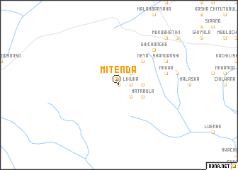
Mitenda (Central, Zambia)Mitenda is a town in the Central region of Zambia. An overview map of the region around Mitenda is displayed below.
regional and 3d topo map of Mitenda, Zambia ::
Mitenda airports ::
The nearest airport is LUN - Lusaka Intl, located 95.2 km south east of Mitenda.
Other airports nearby include KAB - Kariba Intl (216.9 km south east), NLA - Ndola (243.8 km north east), Nearby towns ::
Mande (0.0km north) //
Kabulushe (1.8km east) //
Likuka (1.8km east) //
Mande (2.6km south east) //
Likuku (2.6km north east) //
Kanyumbu (3.6km east) //
Matabula (4.0km south east) //
Meya (5.2km north east) //
Nkuwa (7.4km east) //
Shichongwe (7.7km north east) //
Shanobe (7.7km north east) //
Lwambula (8.1km north east) //
Shandanshi (8.1km north east) //
Makusa (10.3km north east) //
Mukubwe-Tiki (10.3km north east) //
[all distances 'as the bird flies' and approximate] 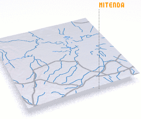 Places with similar names to Mitenda, Zambia ::
Disclaimer :: Information on this page comes without warranty of any kind |
||
|
Where is Mitenda? Elevation and coordinates ::
Latitude (lat): 14°58'0"S Longitude (lon): 27°39'0"E
Elevation (approx.): 1154m (map arrows pan, magnifying glasses zoom) |
||
|
Visiting Mitenda? Hotel/Accommodation ::
Book a hotel in Mitenda Travel Guide ::
Buy a travel guide for Zambia rental cars ::
car rental offers GPS waypoint ::
download a GPX waypoint (PoI) of Mitenda for your GPS receiver
|
||