|
search place name
|
||
Mufumbo (Western, Zambia)Mufumbo is a town in the Western region of Zambia. An overview map of the region around Mufumbo is displayed below.
regional and 3d topo map of Mufumbo, Zambia ::
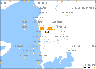
Nearby towns ::
Lukulu (1.8km west) //
Chimbonda (1.9km south) //
Munyakatondo (2.6km north west) //
Sitiba (2.6km north west) //
Chilunda (2.6km south east) //
Chizaza (2.6km south east) //
Likulunu (2.6km south east) //
Kashushu (2.6km south west) //
Sancta Maria (2.6km south west) //
Sakulanda (2.6km south west) //
Bindinda (2.6km south west) //
Imbuwa (3.6km west) //
Mubeto (3.6km west) //
Ngenda (4.1km north west) //
Siliba (4.1km north west) //
Likulunga (4.1km north west) //
Salidunda (4.1km north west) //
Ngweshi (4.1km north west) //
Mwanina (4.1km north west) //
Kashandi (4.0km south east) //
Kabangu (4.0km south west) //
Kaundula (4.0km south west) //
Chiwishi (4.1km south west) //
Mukelabai (4.1km south west) //
Luanchuma (5.2km north east) //
Sitameno (5.2km north west) //
Kufanga (5.2km north west) //
Mwandi Kuta (5.2km south west) //
Muyelu (5.4km east) //
[all distances 'as the bird flies' and approximate] 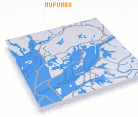 Places with similar names to Mufumbo, Zambia ::
Disclaimer :: Information on this page comes without warranty of any kind |
||
|
Where is Mufumbo? Elevation and coordinates ::
Latitude (lat): 14°23'0"S Longitude (lon): 23°16'0"E
Elevation (approx.): 1054m (map arrows pan, magnifying glasses zoom) |
||
|
Visiting Mufumbo? Hotel/Accommodation ::
Book a hotel in Mufumbo Travel Guide ::
Buy a travel guide for Zambia rental cars ::
car rental offers GPS waypoint ::
download a GPX waypoint (PoI) of Mufumbo for your GPS receiver
|
||