|
search place name
|
||
Mukelekete (Western, Zambia)Mukelekete is a town in the Western region of Zambia. An overview map of the region around Mukelekete is displayed below.
regional and 3d topo map of Mukelekete, Zambia ::
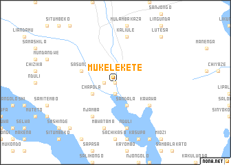
Nearby towns ::
Mutondo (0.0km north) //
Chilila (1.8km west) //
Mumbanyu (1.9km south) //
Ndeho (1.9km south) //
Sakuhuka (1.9km south) //
Kanoka (1.9km south) //
Chapola (4.0km south west) //
Sandala (4.1km south east) //
Sasunga (5.7km west) //
Chinyawa (5.7km west) //
Njamba (6.6km south west) //
Kawawa (6.5km south east) //
Mbwatama (7.6km south) //
Nduli (7.6km south) //
Kaliule (7.6km north) //
Chilikama (10.3km south west) //
Lutesa (10.3km north east) //
[all distances 'as the bird flies' and approximate] 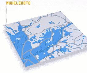 Places with similar names to Mukelekete, Zambia ::
// Mëklakhti (RU)
// Makolokoto (CD)
// Mokalakata (CD)
// Magalegoda (LK)
// Magallagoda (LK)
// Mukeleketa (ZM)
// Makalakatu (TZ)
// Mauca Llacta (PE)
// Maucallacta (PE)
// Maucallacta (PE)
Disclaimer :: Information on this page comes without warranty of any kind |
||
|
Where is Mukelekete? Elevation and coordinates ::
Latitude (lat): 14°3'0"S Longitude (lon): 23°2'0"E
Elevation (approx.): 1037m (map arrows pan, magnifying glasses zoom) |
||
|
Visiting Mukelekete? Hotel/Accommodation ::
Book a hotel in Mukelekete Travel Guide ::
Buy a travel guide for Zambia rental cars ::
car rental offers GPS waypoint ::
download a GPX waypoint (PoI) of Mukelekete for your GPS receiver
|
||