|
search place name
|
||
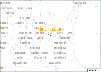
Muletelelwa (Northern, Zambia)Muletelelwa is a town in the Northern region of Zambia. An overview map of the region around Muletelelwa is displayed below.
regional and 3d topo map of Muletelelwa, Zambia ::
Muletelelwa airports ::
The nearest airport is KGJ - Karonga, located 53.5 km north east of Muletelelwa.
Other airports nearby include ZZU - Mzuzu (147.6 km south east), Nearby towns ::
Mwini Kuya (1.8km east) //
Chimudeke (3.6km west) //
Mulambi (3.6km west) //
Mwiya (3.6km east) //
Lunga (4.1km south west) //
Musangama (4.1km north west) //
Mutetawa (5.2km north west) //
Yoram Kayila (5.2km south east) //
Job Muwowo (5.8km east) //
Kasowa (6.6km south east) //
Tom Kasonde (6.6km south east) //
Kama (7.3km east) //
Kaseya (7.6km south) //
Mwini Lunga (7.8km south west) //
Peter Kaila (8.3km south east) //
Munasanga (8.3km south east) //
Chisimba (9.2km south west) //
Jones Kaila (9.2km south east) //
Mwimba (9.2km south east) //
[all distances 'as the bird flies' and approximate] 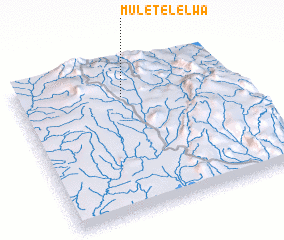 Places with similar names to Muletelelwa, Zambia :: Disclaimer :: Information on this page comes without warranty of any kind |
||
|
Where is Muletelelwa? Elevation and coordinates ::
Latitude (lat): 10°13'0"S Longitude (lon): 33°29'0"E
Elevation (approx.): 1692m (map arrows pan, magnifying glasses zoom) |
||
|
Visiting Muletelelwa? Hotel/Accommodation ::
Book a hotel in Muletelelwa Travel Guide ::
Buy a travel guide for Zambia rental cars ::
car rental offers GPS waypoint ::
download a GPX waypoint (PoI) of Muletelelwa for your GPS receiver
|
||