|
search place name
|
||
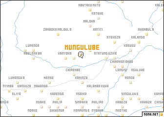
Mungulube (Eastern, Zambia)Mungulube is a town in the Eastern region of Zambia. An overview map of the region around Mungulube is displayed below.
regional and 3d topo map of Mungulube, Zambia ::
Mungulube airports ::
The nearest airport is MFU - Mfuwe, located 170.2 km north east of Mungulube.
Nearby towns ::
Viliwili (1.8km west) //
Malipa (2.6km north east) //
Kanyoka (3.6km west) //
Chipembe (4.1km south west) //
Nyatunguzike (5.4km east) //
Kaminza (5.6km south) //
Matiti (6.6km north east) //
Maala (7.2km east) //
Malowa (7.6km north) //
Chilye (7.4km east) //
Nyanchinko (7.7km north west) //
Zambo Kapalaula (7.7km north west) //
Mtekeza (8.1km north east) //
Kalambakuwa (8.2km south east) //
Menso (9.1km south west) //
[all distances 'as the bird flies' and approximate]  Places with similar names to Mungulube, Zambia ::
Disclaimer :: Information on this page comes without warranty of any kind |
||
|
Where is Mungulube? Elevation and coordinates ::
Latitude (lat): 14°29'0"S Longitude (lon): 30°59'0"E
Elevation (approx.): 857m (map arrows pan, magnifying glasses zoom) |
||
|
Visiting Mungulube? Hotel/Accommodation ::
Book a hotel in Mungulube Travel Guide ::
Buy a travel guide for Zambia rental cars ::
car rental offers GPS waypoint ::
download a GPX waypoint (PoI) of Mungulube for your GPS receiver
|
||