|
search place name
|
||
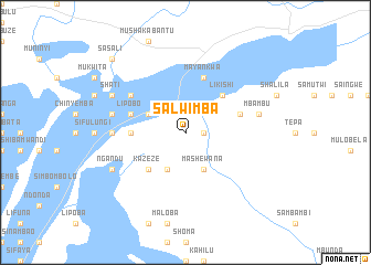
Salwimba (Western, Zambia)Salwimba is a town in the Western region of Zambia. An overview map of the region around Salwimba is displayed below.
regional and 3d topo map of Salwimba, Zambia ::
Nearby towns ::
Katumba (1.8km east) //
Kakumba (1.8km east) //
Fufutu (4.0km north west) //
Mashewana (4.1km south east) //
Kankombwe (4.1km south east) //
Lingoti (4.1km south west) //
Likishi (5.2km north east) //
Kazeze (5.2km south west) //
Kapondola (5.4km west) //
Kazekulu (5.4km west) //
Lipobo (5.7km west) //
Kapeku (5.7km east) //
Mayankwa (5.8km north) //
Sakambanja (5.7km east) //
Ikandulu (6.5km north west) //
Shawalala (7.2km west) //
Mutama (7.2km west) //
Mbambu (7.4km east) //
Ikanjiwa (7.4km west) //
Shati (8.1km north west) //
Imusunga (8.1km north west) //
Ngandu (8.1km south west) //
Mayankwa (8.1km south west) //
Sasali (10.3km north west) //
Sabimbu (10.3km north west) //
[all distances 'as the bird flies' and approximate] 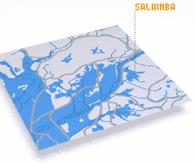 Places with similar names to Salwimba, Zambia ::
// Salwemba (ZM)
Disclaimer :: Information on this page comes without warranty of any kind |
||
|
Where is Salwimba? Elevation and coordinates ::
Latitude (lat): 14°29'0"S Longitude (lon): 23°52'0"E
Elevation (approx.): 1073m (map arrows pan, magnifying glasses zoom) |
||
|
Visiting Salwimba? Hotel/Accommodation ::
Book a hotel in Salwimba Travel Guide ::
Buy a travel guide for Zambia rental cars ::
car rental offers GPS waypoint ::
download a GPX waypoint (PoI) of Salwimba for your GPS receiver
|
||