|
search place name
|
||
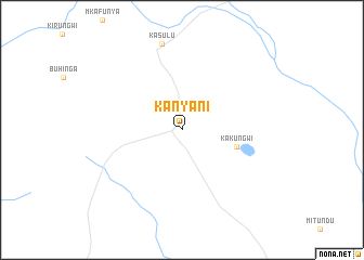
Kanyani (Kigoma, Tanzania)Kanyani is a town in the Kigoma region of Tanzania. An overview map of the region around Kanyani is displayed below.
regional and 3d topo map of Kanyani, Tanzania ::
Kanyani airports ::
The nearest airport is FMI - Kalemie, located 165.8 km south west of Kanyani.
Other airports nearby include BJM - Bujumbura Intl (172.2 km north west), Nearby towns ::
 Places with similar names to Kanyani, Tanzania ::
// Göynüyǝn (AZ)
// Canayan (PH)
// Canayaon (PH)
// Canayun (PH)
// Caonayan (PH)
// Caunayan (PH)
// Guinauayan (PH)
// Guinauayan (PH)
// Guinayan (PH)
// Kaunayan (PH)
Disclaimer :: Information on this page comes without warranty of any kind |
||
|
Where is Kanyani? Elevation and coordinates ::
Latitude (lat): 4°39'23"S Longitude (lon): 30°7'15"E
Elevation (approx.): 1299m (map arrows pan, magnifying glasses zoom) |
||
|
Visiting Kanyani? Hotel/Accommodation ::
Book a hotel in Kanyani Travel Guide ::
Buy a travel guide for Tanzania rental cars ::
car rental offers GPS waypoint ::
download a GPX waypoint (PoI) of Kanyani for your GPS receiver
|
||