|
search place name
|
||
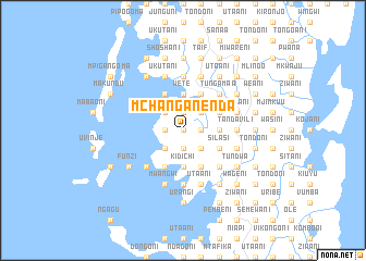
Mchanganenda (Tanzania)Mchanganenda is a town in Tanzania. An overview map of the region around Mchanganenda is displayed below.
regional and 3d topo map of Mchanganenda, Tanzania ::
Mchanganenda airports ::
The nearest airport is PMA - Pemba, located 20.3 km south east of Mchanganenda.
Other airports nearby include TGT - Tanga (71.6 km west), MBA - Mombasa Moi Intl (118.6 km north), ZNZ - Zanzibar (135.5 km south west), DAR - Dar Es Salaam Mwalimu Julius K Nyerere Intl (204.7 km south), Nearby towns ::
Jekunje (0.0km north) //
Magogoni (0.0km north) //
Mgoli (0.0km north) //
Limani (1.8km east) //
Uta wa Limani (1.8km east) //
Kitundwini (1.8km west) //
Chanjani (1.8km west) //
Mgogoni (1.8km west) //
Mpakanjia (1.8km west) //
Chapaka (1.8km west) //
Utaani (1.8km west) //
Uwondwe (1.9km north) //
Nyali (1.9km north) //
Mkwajuni (1.9km south) //
Mzingani (1.9km south) //
Kigongoni (1.9km north) //
Utaani (1.9km north) //
Daya (1.9km south) //
Pasi (1.9km north) //
Kikungeni (1.9km south) //
Baoni (2.6km south east) //
Patungu (2.6km south east) //
Mitambwini (2.6km north east) //
Kizimbani (2.6km south east) //
Kelle (2.6km north east) //
Tondoni (2.6km south west) //
Jambaji (2.6km north west) //
Chekea (2.6km north west) //
Hurumzi (2.6km south west) //
[all distances 'as the bird flies' and approximate] 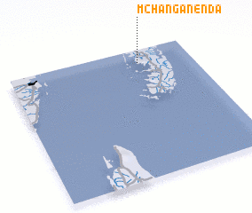 Places with similar names to Mchanganenda, Tanzania :: Disclaimer :: Information on this page comes without warranty of any kind |
||
|
Where is Mchanganenda? Elevation and coordinates ::
Latitude (lat): 5°6'0"S Longitude (lon): 39°43'0"E
Elevation (approx.): 53m (map arrows pan, magnifying glasses zoom) |
||
|
Visiting Mchanganenda? Hotel/Accommodation ::
Book a hotel in Mchanganenda Travel Guide ::
Buy a travel guide for Tanzania rental cars ::
car rental offers GPS waypoint ::
download a GPX waypoint (PoI) of Mchanganenda for your GPS receiver
|
||