|
search place name
|
||
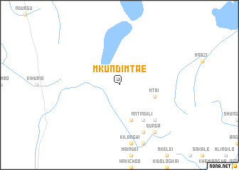
Mkundi Mtae (Tanzania)Mkundi Mtae is a town in Tanzania. An overview map of the region around Mkundi Mtae is displayed below.
regional and 3d topo map of Mkundi Mtae, Tanzania ::
Mkundi Mtae airports ::
The nearest airport is TGT - Tanga, located 120.4 km south east of Mkundi Mtae.
Other airports nearby include MBA - Mombasa Moi Intl (163.8 km east), JRO - Kilimanjaro Intl (168.3 km north west), PMA - Pemba (200.6 km south east), ARK - Arusha (210.7 km north west), Nearby towns ::
Mtai (5.8km east) //
Kigunga (5.9km south) //
Mntindili (6.7km south east) //
Chumbageni (7.9km south east) //
Malutaute (8.3km south east) //
Shome (8.3km south east) //
Hebula (9.3km south east) //
Halomo (9.3km south east) //
Sunga (9.3km south east) //
[all distances 'as the bird flies' and approximate] 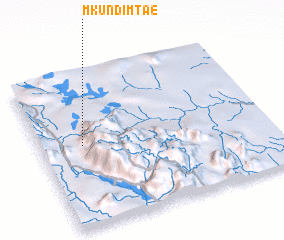 Places with similar names to Mkundi Mtae, Tanzania ::
// Mkandamoto (MW)
Disclaimer :: Information on this page comes without warranty of any kind |
||
|
Where is Mkundi Mtae? Elevation and coordinates ::
Latitude (lat): 4°28'0"S Longitude (lon): 38°11'0"E
Elevation (approx.): 620m (map arrows pan, magnifying glasses zoom) |
||
|
Visiting Mkundi Mtae? Hotel/Accommodation ::
Book a hotel in Mkundi Mtae Travel Guide ::
Buy a travel guide for Tanzania rental cars ::
car rental offers GPS waypoint ::
download a GPX waypoint (PoI) of Mkundi Mtae for your GPS receiver
|
||