|
search place name
|
||
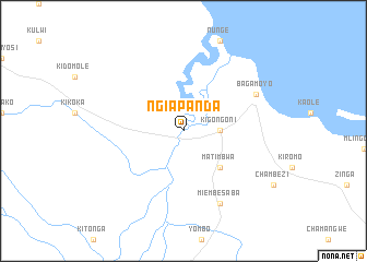
Ngiapanda (Tanzania)Ngiapanda is a town in Tanzania. An overview map of the region around Ngiapanda is displayed below.
regional and 3d topo map of Ngiapanda, Tanzania ::
Ngiapanda airports ::
The nearest airport is ZNZ - Zanzibar, located 51.1 km north east of Ngiapanda.
Other airports nearby include DAR - Dar Es Salaam Mwalimu Julius K Nyerere Intl (61.1 km south east), TGT - Tanga (154.2 km north), PMA - Pemba (172.1 km north east), Nearby towns ::
Kigongoni (3.7km east) //
Matimbwa (5.2km south east) //
Miembesaba (8.3km south east) //
Bagamoyo (8.2km north east) //
[all distances 'as the bird flies' and approximate] 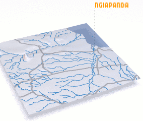 Places with similar names to Ngiapanda, Tanzania ::
// Njiapanda (TZ)
Disclaimer :: Information on this page comes without warranty of any kind |
||
|
Where is Ngiapanda? Elevation and coordinates ::
Latitude (lat): 6°28'0"S Longitude (lon): 38°50'0"E
Elevation (approx.): 4m (map arrows pan, magnifying glasses zoom) |
||
|
Visiting Ngiapanda? Hotel/Accommodation ::
Book a hotel in Ngiapanda Travel Guide ::
Buy a travel guide for Tanzania rental cars ::
car rental offers GPS waypoint ::
download a GPX waypoint (PoI) of Ngiapanda for your GPS receiver
|
||