|
search place name
|
||
Bandajuma (Eastern, Sierra Leone)Bandajuma is a town in the Eastern region of Sierra Leone. An overview map of the region around Bandajuma is displayed below.
regional and 3d topo map of Bandajuma, Sierra Leone ::

Bandajuma airports ::
The nearest airport is MLW - Monrovia Spriggs Payne, located 209.9 km south of Bandajuma.
Other airports nearby include FAA - Faranah (212.3 km north), ROB - Monrovia Roberts Intl (228.4 km south), Nearby towns ::
Ketuma (1.8km west) //
Yandehun (2.6km north east) //
Panguma (3.7km north) //
Fulawahun (3.7km south) //
Dodo (3.7km west) //
Kamboma-Mamayema (4.1km south east) //
Gurala (4.1km south west) //
Toyama (4.1km north west) //
Kambeyama (5.2km north west) //
Bobobu (5.2km north west) //
Maka (5.2km south west) //
Piwoma (5.2km south west) //
Jolu (5.9km south) //
Giehun (5.8km east) //
Belihu (5.9km south) //
Koyehun (5.8km east) //
Sewaoma (5.8km east) //
Gbondu (5.9km south) //
Pegama (6.6km south west) //
Bumbe (6.7km north east) //
Lalehun (6.6km north east) //
Nenehun (6.7km north west) //
Baoma (6.7km south west) //
Gorala (7.4km north) //
Sagpati (7.3km west) //
Duvubu (7.6km south) //
Yibema (7.6km west) //
Gandorhun (7.6km west) //
Pangbalia (7.8km north west) //
[all distances 'as the bird flies' and approximate] 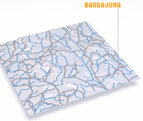 Places with similar names to Bandajuma, Sierra Leone ::
// Bendjamou (TD)
// Bindjom (TD)
// Bandjambo (CD)
// Banou Djoumba (NE)
// Béné Djouma (SN)
// Bandajuma (SL)
// Bandajuma (SL)
// Bandajuma (SL)
// Bandajuma (SL)
// Bandajuma (SL)
Disclaimer :: Information on this page comes without warranty of any kind |
||
|
Where is Bandajuma? Elevation and coordinates ::
Latitude (lat): 8°9'0"N Longitude (lon): 11°8'0"W
Elevation (approx.): 309m (map arrows pan, magnifying glasses zoom) |
||
|
Visiting Bandajuma? Hotel/Accommodation ::
Book a hotel in Bandajuma Travel Guide ::
rental cars ::
car rental offers GPS waypoint ::
download a GPX waypoint (PoI) of Bandajuma for your GPS receiver
|
||