|
search place name
|
||
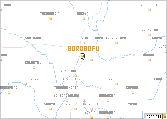
Borobofu (Northern, Sierra Leone)Borobofu is a town in the Northern region of Sierra Leone. An overview map of the region around Borobofu is displayed below.
regional and 3d topo map of Borobofu, Sierra Leone ::
Borobofu airports ::
The nearest airport is FNA - Freetown Lungi, located 124.4 km south west of Borobofu.
Other airports nearby include FIG - Fira Fria (134.6 km north west), LEK - Labe (196.1 km north), FAA - Faranah (208.7 km east), Nearby towns ::
Tambakura (1.8km east) //
Oualia (3.7km north) //
Konta (4.1km south west) //
Kurumbunia (5.2km south west) //
Kuru (5.2km north east) //
Kilitewondi (6.7km south west) //
Dégui (7.8km south west) //
Deguiyangbouan (7.8km south west) //
Yomboro Konta (8.3km south west) //
Takadakura (8.2km north east) //
Yankone (9.2km south east) //
[all distances 'as the bird flies' and approximate]  Places with similar names to Borobofu, Sierra Leone ::
// Brabova (RO)
// Bohr-e Bāgh (IR)
// Bāra Bāghia (BD)
// Bara Bighāi (BD)
// Bar Bigha (IN)
// Bayrabof (UZ)
// Borobof (GN)
// Buyrabov (TJ)
// Barre Bœuf (HT)
// Bairro Boava (BR)
Disclaimer :: Information on this page comes without warranty of any kind |
||
|
Where is Borobofu? Elevation and coordinates ::
Latitude (lat): 9°35'0"N Longitude (lon): 12°37'0"W
Elevation (approx.): 76m (map arrows pan, magnifying glasses zoom) |
||
|
Visiting Borobofu? Hotel/Accommodation ::
Book a hotel in Borobofu Travel Guide ::
rental cars ::
car rental offers GPS waypoint ::
download a GPX waypoint (PoI) of Borobofu for your GPS receiver
|
||