|
search place name
|
||
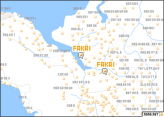
Fakai (Western Area, Sierra Leone)Fakai is a town in the Western Area region of Sierra Leone. An overview map of the region around Fakai is displayed below.
regional and 3d topo map of Fakai, Sierra Leone ::
Fakai airports ::
The nearest airport is FNA - Freetown Lungi, located 28.0 km north west of Fakai.
Other airports nearby include FIG - Fira Fria (223.1 km north), Nearby towns ::
Mabangura (0.7km east) //
Bakebana (0.9km north) //
Juite Town (1.4km west) //
Mabokari (1.5km south east) //
Kumrabai (1.7km north) //
Masoko (1.7km south east) //
Johntop (1.9km west) //
Malimba (2.6km east) //
Susu Town (2.7km south west) //
Forodugu (3.1km north east) //
Kamatereh (3.2km north) //
Yof (3.3km north) //
Pa Lokko (3.6km south east) //
Yemere (3.7km south east) //
Devil Hole (3.8km south west) //
Masinka (3.9km east) //
Rokel (4.1km west) //
Moyah (4.1km south east) //
Loko (4.3km east) //
Depea Water (4.3km south) //
Yams Farm (4.4km west) //
Sumbuya (4.5km north) //
Masantigi (4.6km south east) //
Ro-bungba (4.6km west) //
Mabaya (4.9km north west) //
Mademokai (4.9km east) //
Ro-Yema (5.0km east) //
Gberi (5.1km north east) //
Miami (5.2km south east) //
[all distances 'as the bird flies' and approximate]  Places with similar names to Fakai, Sierra Leone ::
Disclaimer :: Information on this page comes without warranty of any kind |
||
|
Where is Fakai? Elevation and coordinates ::
Latitude (lat): 8°23'44"N Longitude (lon): 13°4'15"W
Elevation (approx.): 6m (map arrows pan, magnifying glasses zoom) |
||
|
Visiting Fakai? Hotel/Accommodation ::
Book a hotel in Fakai Travel Guide ::
rental cars ::
car rental offers GPS waypoint ::
download a GPX waypoint (PoI) of Fakai for your GPS receiver
|
||