|
search place name
|
||
Fanye (Northern, Sierra Leone)Fanye is a town in the Northern region of Sierra Leone. An overview map of the region around Fanye is displayed below.
regional and 3d topo map of Fanye, Sierra Leone ::

Fanye airports ::
The nearest airport is FNA - Freetown Lungi, located 34.4 km west of Fanye.
Other airports nearby include FIG - Fira Fria (204.3 km north), Nearby towns ::
Lawmpa (1.9km south) //
Maboni (1.8km west) //
Benkia (2.6km north west) //
Mabundu (3.7km south) //
Mamina (3.7km east) //
Bumplol (3.7km north) //
Taiama (4.1km south east) //
Konta (4.1km south east) //
Making (4.1km south west) //
Magbansaw (4.1km north west) //
Makelfa (5.2km south east) //
Makaba (5.2km south west) //
Makoya (5.6km north) //
Masankin (5.6km south) //
Gbonkomayira (5.9km north) //
Bambali (5.8km east) //
Masebe (5.9km south) //
Polot (5.9km north) //
Makurubulai (6.6km south west) //
Masimaw (6.6km south east) //
Petifu (6.7km north west) //
Madik (6.6km north west) //
Masom (6.6km north west) //
Bonkiri (6.6km north east) //
Tauya (7.2km west) //
Korrata (7.4km south) //
Mafari (7.4km north) //
Samarank (7.6km south) //
Makoya (7.6km east) //
[all distances 'as the bird flies' and approximate] 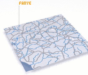 Places with similar names to Fanye, Sierra Leone ::
Disclaimer :: Information on this page comes without warranty of any kind |
||
|
Where is Fanye? Elevation and coordinates ::
Latitude (lat): 8°38'0"N Longitude (lon): 12°53'0"W
Elevation (approx.): 18m (map arrows pan, magnifying glasses zoom) |
||
|
Visiting Fanye? Hotel/Accommodation ::
Book a hotel in Fanye Travel Guide ::
rental cars ::
car rental offers GPS waypoint ::
download a GPX waypoint (PoI) of Fanye for your GPS receiver
|
||