|
search place name
|
||
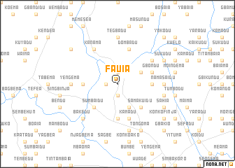
Fauia (Eastern, Sierra Leone)Fauia is a town in the Eastern region of Sierra Leone. An overview map of the region around Fauia is displayed below.
regional and 3d topo map of Fauia, Sierra Leone ::
Fauia airports ::
The nearest airport is FAA - Faranah, located 150.3 km north of Fauia.
Nearby towns ::
Yomadu (1.9km north) //
Sedu (1.9km north) //
Njafoia (1.9km south) //
Sedukonkoma (1.8km west) //
Yadusinero (4.1km north east) //
Kamadonkea (4.1km south east) //
Samakuidu (5.2km south east) //
Sumbaidu (5.2km south west) //
Fimbaia (5.6km south) //
Dombadu (5.5km east) //
Konkombadu (5.5km west) //
Gbondu (5.8km east) //
Kamadu (5.9km south) //
Dombadu (5.9km north) //
Peyima (6.6km north east) //
Kanama (6.7km north west) //
Tegbadu (7.4km north) //
Namasaidu (7.3km east) //
Yengema (7.3km west) //
Dembema (7.6km south) //
Peyima (7.6km east) //
Bakedu (7.8km south west) //
Tongoma (8.3km south east) //
Sukudu (8.2km north east) //
Sahia (8.2km south east) //
Konkofinja (9.2km south east) //
Gbekawraw (9.2km north west) //
Yokodu (10.4km north east) //
Gbakio (10.4km south east) //
[all distances 'as the bird flies' and approximate] 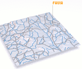 Places with similar names to Fauia, Sierra Leone ::
Disclaimer :: Information on this page comes without warranty of any kind |
||
|
Where is Fauia? Elevation and coordinates ::
Latitude (lat): 8°43'0"N Longitude (lon): 11°6'0"W
Elevation (approx.): 412m (map arrows pan, magnifying glasses zoom) |
||
|
Visiting Fauia? Hotel/Accommodation ::
Book a hotel in Fauia Travel Guide ::
rental cars ::
car rental offers GPS waypoint ::
download a GPX waypoint (PoI) of Fauia for your GPS receiver
|
||