|
search place name
|
||
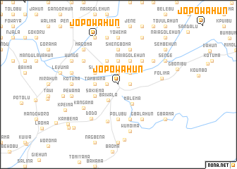
Jopowahun (Eastern, Sierra Leone)Jopowahun is a town in the Eastern region of Sierra Leone. An overview map of the region around Jopowahun is displayed below.
regional and 3d topo map of Jopowahun, Sierra Leone ::
Jopowahun airports ::
The nearest airport is MLW - Monrovia Spriggs Payne, located 191.6 km south of Jopowahun.
Other airports nearby include ROB - Monrovia Roberts Intl (199.4 km south), Nearby towns ::
Bomaru (1.8km east) //
Salon (1.9km north) //
Poruma (1.8km east) //
Kpeyama (1.8km west) //
Dakaw (2.6km north east) //
Fumbala (2.6km north east) //
Baiwala (2.9km south west) //
Jawu (3.7km north) //
Tambiama (3.7km west) //
Malema (3.8km south east) //
Naiagolehun (4.1km north east) //
Kponporu (4.1km north west) //
Siama (4.1km north west) //
Sakiema (4.1km south west) //
Gondama (5.2km north east) //
Polubu (5.6km south) //
Shengboma (5.6km north) //
Grima (5.9km south) //
Baoma (5.9km north) //
Bogema (6.1km south) //
Manoworo (6.6km north west) //
Gbalahun (6.7km south east) //
Blama (6.6km north east) //
Kangama (6.6km south west) //
Dodo (6.9km south west) //
Folima (6.9km east) //
Yowema (7.4km north) //
Kotuma (7.3km west) //
Humalahun (7.6km north) //
[all distances 'as the bird flies' and approximate] 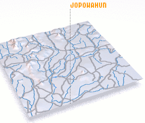 Places with similar names to Jopowahun, Sierra Leone ::
Disclaimer :: Information on this page comes without warranty of any kind |
||
|
Where is Jopowahun? Elevation and coordinates ::
Latitude (lat): 8°1'0"N Longitude (lon): 10°38'0"W
Elevation (approx.): 197m (map arrows pan, magnifying glasses zoom) |
||
|
Visiting Jopowahun? Hotel/Accommodation ::
Book a hotel in Jopowahun Travel Guide ::
rental cars ::
car rental offers GPS waypoint ::
download a GPX waypoint (PoI) of Jopowahun for your GPS receiver
|
||