|
search place name
|
||
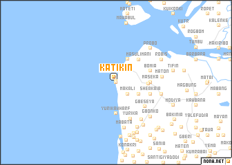
Katikin (Northern, Sierra Leone)Katikin is a town in the Northern region of Sierra Leone. An overview map of the region around Katikin is displayed below.
regional and 3d topo map of Katikin, Sierra Leone ::
Katikin airports ::
The nearest airport is FNA - Freetown Lungi, located 21.2 km south of Katikin.
Other airports nearby include FIG - Fira Fria (175.0 km north), Nearby towns ::
Petifu (0.0km north) //
Masisi (0.2km north) //
Robe (1.9km north) //
Barlo (2.5km north east) //
Makali (2.6km south east) //
Kumrabai (4.1km south east) //
Barlo Wharf (4.2km north east) //
Yurika Wharf (5.1km south) //
Musaia (5.2km east) //
Masulimani (5.2km north east) //
Maseka (5.5km east) //
Sheakaia (5.8km east) //
Bomia (5.8km east) //
Gbeseya (6.1km south east) //
Yurika (6.3km south) //
Kenkeli (7.2km south east) //
Mabata (7.4km south) //
Maton (7.5km east) //
Roten (7.6km east) //
Probo (7.8km north east) //
Gbonko (7.8km south east) //
Satamodia (8.0km south east) //
Robumpah (8.2km south east) //
Robis (8.2km north east) //
Tadi (8.7km south) //
Heremankono (8.8km south) //
Kuntaia (8.8km south east) //
Manika (8.9km south) //
Gbonkowili (10.0km south east) //
[all distances 'as the bird flies' and approximate]  Places with similar names to Katikin, Sierra Leone ::
Disclaimer :: Information on this page comes without warranty of any kind |
||
|
Where is Katikin? Elevation and coordinates ::
Latitude (lat): 8°48'0"N Longitude (lon): 13°15'0"W
Elevation (approx.): -32768m (map arrows pan, magnifying glasses zoom) |
||
|
Visiting Katikin? Hotel/Accommodation ::
Book a hotel in Katikin Travel Guide ::
rental cars ::
car rental offers GPS waypoint ::
download a GPX waypoint (PoI) of Katikin for your GPS receiver
|
||