|
search place name
|
||
Kongabahun (Southern, Sierra Leone)Kongabahun is a town in the Southern region of Sierra Leone. An overview map of the region around Kongabahun is displayed below.
regional and 3d topo map of Kongabahun, Sierra Leone ::

Kongabahun airports ::
The nearest airport is FNA - Freetown Lungi, located 175.1 km west of Kongabahun.
Other airports nearby include FAA - Faranah (227.3 km north east), MLW - Monrovia Spriggs Payne (232.3 km south east), ROB - Monrovia Roberts Intl (259.3 km south east), Nearby towns ::
Jalwala (2.6km south west) //
Gba (2.6km south east) //
Hendobu (2.6km north east) //
Jaro (3.7km north) //
Bitima (4.1km south west) //
Panguma (4.1km south west) //
Mandu (4.1km north west) //
Dandabu (4.1km south east) //
Tombalu (4.1km south east) //
Semabu (4.1km north east) //
Tokpombu (5.2km south east) //
Kenema (5.2km north east) //
Kondoma (5.5km west) //
Jago (5.5km east) //
Jagbwema (5.6km north) //
Nyandeama (5.6km north) //
Bumbe (5.9km south) //
Pondonga (5.8km west) //
Negbema (5.9km south) //
Buyehun (6.6km south west) //
Petema (6.6km north east) //
Mogbwe (6.7km north east) //
Sioma (7.3km east) //
Magbwema (7.3km east) //
Lembilema (7.6km south) //
Sahun (7.6km east) //
Giema (7.6km north) //
Tondoya (7.8km south east) //
Ganjama (7.8km north east) //
[all distances 'as the bird flies' and approximate] 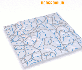 Places with similar names to Kongabahun, Sierra Leone ::
// Cang-abuhon (PH)
Disclaimer :: Information on this page comes without warranty of any kind |
||
|
Where is Kongabahun? Elevation and coordinates ::
Latitude (lat): 8°11'0"N Longitude (lon): 11°40'0"W
Elevation (approx.): 115m (map arrows pan, magnifying glasses zoom) |
||
|
Visiting Kongabahun? Hotel/Accommodation ::
Book a hotel in Kongabahun Travel Guide ::
rental cars ::
car rental offers GPS waypoint ::
download a GPX waypoint (PoI) of Kongabahun for your GPS receiver
|
||