|
search place name
|
||
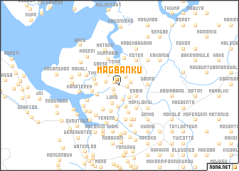
Magbanku (Northern, Sierra Leone)Magbanku is a town in the Northern region of Sierra Leone. An overview map of the region around Magbanku is displayed below.
regional and 3d topo map of Magbanku, Sierra Leone ::
Magbanku airports ::
The nearest airport is FNA - Freetown Lungi, located 27.8 km north west of Magbanku.
Other airports nearby include FIG - Fira Fria (220.5 km north), Nearby towns ::
Magbema (1.0km north west) //
Mate (1.1km south west) //
Kumrabai (1.2km east) //
Gberi (1.7km south west) //
Matam (1.7km north east) //
Matombo (1.8km east) //
Gbap (2.2km west) //
Mapiret (2.3km north) //
Mayoko (2.4km south) //
Marifa (2.4km north west) //
Malahaisoko (2.5km south east) //
Loko (2.9km south) //
Yema (3.0km north) //
Mawoto (3.0km north) //
Konta (3.0km north east) //
Robia (3.1km south east) //
Ro-Yema (3.3km south) //
Matoli (3.6km south) //
Sumbuya (3.6km west) //
Forodugu (3.7km south west) //
Gbese (3.8km north west) //
Timbo (4.0km west) //
Masinka (4.2km south) //
Makenkin (4.4km north) //
Yof (4.3km west) //
Mafile (4.4km south east) //
Sanda (4.5km south) //
Gboro (4.5km east) //
Kumrabai (4.5km north west) //
[all distances 'as the bird flies' and approximate] 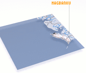 Places with similar names to Magbanku, Sierra Leone ::
// Macaw Bank (BZ)
// Macaw Bank (BZ)
// Macabbungao (PH)
// Magbang (PH)
// Maquebenga (PH)
// Magobeng (ZA)
// Magobeng (ZA)
// Mokobeng (BW)
// Magbanga (CD)
// Makabongo (CD)
Disclaimer :: Information on this page comes without warranty of any kind |
||
|
Where is Magbanku? Elevation and coordinates ::
Latitude (lat): 8°25'55"N Longitude (lon): 13°1'26"W
Elevation (approx.): 38m (map arrows pan, magnifying glasses zoom) |
||
|
Visiting Magbanku? Hotel/Accommodation ::
Book a hotel in Magbanku Travel Guide ::
rental cars ::
car rental offers GPS waypoint ::
download a GPX waypoint (PoI) of Magbanku for your GPS receiver
|
||