|
search place name
|
||
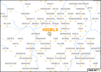
Magbila (Northern, Sierra Leone)Magbila is a town in the Northern region of Sierra Leone. An overview map of the region around Magbila is displayed below.
regional and 3d topo map of Magbila, Sierra Leone ::
Magbila airports ::
The nearest airport is FNA - Freetown Lungi, located 93.0 km west of Magbila.
Other airports nearby include FAA - Faranah (259.9 km north east), Nearby towns ::
Bankafu (1.9km south) //
Taua (2.6km south east) //
Mangoni (3.7km south) //
Jopowahun (3.7km south) //
Periwahun (4.1km south west) //
Periwahun (4.1km south west) //
Pujehun (4.1km north east) //
Ronuri (4.1km north east) //
Mafokoya (4.1km north west) //
Falaba (5.2km south east) //
Batbana (5.5km west) //
Bambaworo (5.5km east) //
Mangara (5.6km north) //
Mokaima (5.8km west) //
Semabu (5.8km east) //
Periwahun (5.9km south) //
Wangele (5.8km east) //
Roban (5.9km north) //
Kowama (6.7km south west) //
Roruks (6.7km north west) //
Mayora (6.7km north west) //
Rokrot (6.7km north east) //
Banbut (6.6km north west) //
Mabendu (6.6km north east) //
Gbahama (7.3km east) //
Makagbo (7.4km north) //
Gerehun (7.6km south) //
Kongo (7.6km east) //
Kaprsanka (7.6km north) //
[all distances 'as the bird flies' and approximate] 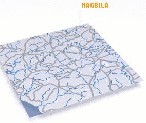 Places with similar names to Magbila, Sierra Leone ::
Disclaimer :: Information on this page comes without warranty of any kind |
||
|
Where is Magbila? Elevation and coordinates ::
Latitude (lat): 8°20'0"N Longitude (lon): 12°24'0"W
Elevation (approx.): 66m (map arrows pan, magnifying glasses zoom) |
||
|
Visiting Magbila? Hotel/Accommodation ::
Book a hotel in Magbila Travel Guide ::
rental cars ::
car rental offers GPS waypoint ::
download a GPX waypoint (PoI) of Magbila for your GPS receiver
|
||