|
search place name
|
||
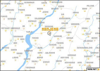
Manjema (Southern, Sierra Leone)Manjema is a town in the Southern region of Sierra Leone. An overview map of the region around Manjema is displayed below.
regional and 3d topo map of Manjema, Sierra Leone ::
Manjema airports ::
The nearest airport is MLW - Monrovia Spriggs Payne, located 131.3 km south east of Manjema.
Other airports nearby include ROB - Monrovia Roberts Intl (164.5 km south east), FNA - Freetown Lungi (245.0 km north west), Nearby towns ::
Gbomei (1.9km south) //
Sengema (2.5km north) //
Dumagbe (3.1km east) //
Golawahun (3.4km west) //
Kenema (4.6km south) //
Vaama (5.0km north west) //
Jibima (5.0km east) //
Tokoma (5.2km south east) //
Fanima (5.8km west) //
Fanima (6.2km south west) //
Madina (6.6km north east) //
Dowoma (6.7km south east) //
Madina (6.6km north west) //
Gajubaoma (6.7km north west) //
Buma (6.7km south west) //
Twasu (7.0km east) //
Golawoma (7.4km south) //
Giehun (7.6km east) //
Njala (7.7km west) //
Kondigbama (7.8km north east) //
Gorahun (7.9km north west) //
Jeoma (8.2km north) //
Blama (8.2km north west) //
Wopo (8.3km south west) //
Gofo (8.4km east) //
Dia (8.5km north east) //
Gonohun (10.4km south west) //
Futa (10.4km south west) //
Vaama (10.6km north west) //
[all distances 'as the bird flies' and approximate] 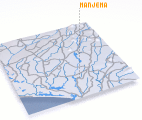 Places with similar names to Manjema, Sierra Leone ::
Disclaimer :: Information on this page comes without warranty of any kind |
||
|
Where is Manjema? Elevation and coordinates ::
Latitude (lat): 7°16'0"N Longitude (lon): 11°26'0"W
Elevation (approx.): 51m (map arrows pan, magnifying glasses zoom) |
||
|
Visiting Manjema? Hotel/Accommodation ::
Book a hotel in Manjema Travel Guide ::
rental cars ::
car rental offers GPS waypoint ::
download a GPX waypoint (PoI) of Manjema for your GPS receiver
|
||