|
search place name
|
||
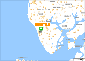
Masoyila (Northern, Sierra Leone)Masoyila is a town in the Northern region of Sierra Leone. An overview map of the region around Masoyila is displayed below.
regional and 3d topo map of Masoyila, Sierra Leone ::
Masoyila airports ::
The nearest airport is FNA - Freetown Lungi, located 1.0 km north west of Masoyila.
Other airports nearby include FIG - Fira Fria (197.0 km north), Nearby towns ::
Kambia (0.8km west) //
Rotifunk (1.2km south east) //
Gbanelol (1.4km north) //
Tulomasaw (1.6km south) //
Tulun (1.7km west) //
Mahera (1.8km south west) //
Kasongha (2.0km east) //
Tumbu Lol (2.2km north east) //
Tumbu Bana (2.2km north east) //
Kamem (2.3km south west) //
Yema (2.3km south east) //
Petifu (2.4km north) //
Yongro (2.4km south west) //
Kasuan (2.7km east) //
Sawkta (2.8km north west) //
Kirima (3.2km north) //
Makasa (3.2km north) //
Tintafor (3.3km north west) //
Robis (3.4km south east) //
Gbonko (3.5km east) //
Rogbanti (3.7km south) //
Maloko (3.8km south east) //
Kurankoya (4.0km north) //
Ponka (4.0km north) //
Kamasundo (4.0km north west) //
Bomodia (4.2km north) //
Bullom (4.3km north east) //
Benke (4.5km north west) //
Bambali (4.7km east) //
[all distances 'as the bird flies' and approximate] 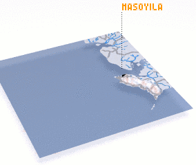 Places with similar names to Masoyila, Sierra Leone ::
// Musayal (AZ)
Disclaimer :: Information on this page comes without warranty of any kind |
||
|
Where is Masoyila? Elevation and coordinates ::
Latitude (lat): 8°36'35"N Longitude (lon): 13°11'24"W
Elevation (approx.): 33m (map arrows pan, magnifying glasses zoom) |
||
|
Visiting Masoyila? Hotel/Accommodation ::
Book a hotel in Masoyila Travel Guide ::
rental cars ::
car rental offers GPS waypoint ::
download a GPX waypoint (PoI) of Masoyila for your GPS receiver
|
||