|
search place name
|
||
Masumana (Northern, Sierra Leone)Masumana is a town in the Northern region of Sierra Leone. An overview map of the region around Masumana is displayed below.
regional and 3d topo map of Masumana, Sierra Leone ::

Masumana airports ::
The nearest airport is FNA - Freetown Lungi, located 46.0 km west of Masumana.
Other airports nearby include FIG - Fira Fria (223.1 km north), Nearby towns ::
Masurakata (1.9km south) //
Mabin (1.9km north) //
Ropat (3.7km west) //
Mayogbo (3.7km east) //
Laia (3.7km north) //
Masire (4.1km south east) //
Yema (4.1km south west) //
Majackson (5.2km north west) //
Makire (5.2km north east) //
Motaiko (5.6km south) //
Magbuntukali (5.8km west) //
Fondu (5.9km south) //
Makonte (5.9km north) //
Makoya (5.9km north) //
Masankere (5.9km south) //
Matei (5.8km east) //
Magbuntuso (6.6km south west) //
Malamina (6.7km south west) //
Masuri (6.7km north west) //
Forodugu (7.4km north) //
Malegbe (7.3km west) //
Gberi (7.4km north) //
Masampa (7.6km south) //
Mahoma (7.6km east) //
Magbeni (7.6km north) //
Kupru (7.8km south west) //
Pebul (8.3km south west) //
Rowal (8.2km south west) //
Mamiri (8.2km north west) //
[all distances 'as the bird flies' and approximate] 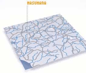 Places with similar names to Masumana, Sierra Leone ::
Disclaimer :: Information on this page comes without warranty of any kind |
||
|
Where is Masumana? Elevation and coordinates ::
Latitude (lat): 8°29'0"N Longitude (lon): 12°48'0"W
Elevation (approx.): 41m (map arrows pan, magnifying glasses zoom) |
||
|
Visiting Masumana? Hotel/Accommodation ::
Book a hotel in Masumana Travel Guide ::
rental cars ::
car rental offers GPS waypoint ::
download a GPX waypoint (PoI) of Masumana for your GPS receiver
|
||