|
search place name
|
||
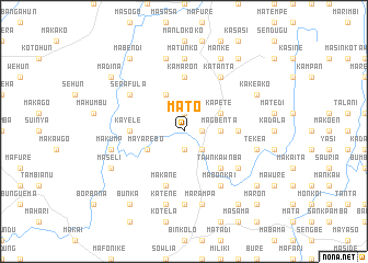
Mato (Northern, Sierra Leone)Mato is a town in the Northern region of Sierra Leone. An overview map of the region around Mato is displayed below.
regional and 3d topo map of Mato, Sierra Leone ::
Mato airports ::
The nearest airport is FNA - Freetown Lungi, located 141.7 km west of Mato.
Other airports nearby include FAA - Faranah (172.1 km north east), FIG - Fira Fria (225.8 km north west), Nearby towns ::
Mafore (1.8km east) //
Kanebo (1.9km south) //
Moi (1.9km north) //
Kapete (1.9km north) //
Katankina (2.6km south east) //
Magbenta (3.7km east) //
Bunbande (4.1km north west) //
Magbane (4.1km north east) //
Kapete (4.1km north east) //
Mayarebo (4.1km south west) //
Tawnkawnba (5.2km south east) //
Kamaron (5.6km north) //
Kayele (5.5km west) //
Kenema (5.5km east) //
Makane (5.9km south) //
Katanta (6.7km north east) //
Serafula (6.6km north west) //
Mabonkai (6.7km south east) //
Kamata (6.6km south east) //
Matunko (7.4km north) //
Kapete (7.4km south) //
Tekea (7.6km east) //
Marampa (7.6km south) //
Mabunko (7.6km north) //
Katene (7.6km south) //
Kabu (7.6km south) //
Makump (7.6km west) //
Kakeako (8.2km north east) //
Manke (8.3km north east) //
[all distances 'as the bird flies' and approximate] 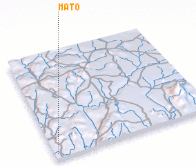 Places with similar names to Mato, Sierra Leone ::
Disclaimer :: Information on this page comes without warranty of any kind |
||
|
Where is Mato? Elevation and coordinates ::
Latitude (lat): 9°3'0"N Longitude (lon): 11°59'0"W
Elevation (approx.): 84m (map arrows pan, magnifying glasses zoom) |
||
|
Visiting Mato? Hotel/Accommodation ::
Book a hotel in Mato Travel Guide ::
rental cars ::
car rental offers GPS waypoint ::
download a GPX waypoint (PoI) of Mato for your GPS receiver
|
||