|
search place name
|
||
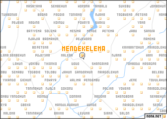
Mendekelema (Eastern, Sierra Leone)Mendekelema is a town in the Eastern region of Sierra Leone. An overview map of the region around Mendekelema is displayed below.
regional and 3d topo map of Mendekelema, Sierra Leone ::
Mendekelema airports ::
The nearest airport is MLW - Monrovia Spriggs Payne, located 205.9 km south of Mendekelema.
Other airports nearby include FAA - Faranah (208.6 km north), ROB - Monrovia Roberts Intl (215.5 km south), Nearby towns ::
Dodo (2.6km south west) //
Botiwa (2.6km north west) //
Blama (2.6km south east) //
Teema (2.6km north east) //
Pejeworo (3.7km north) //
Malema (3.7km west) //
Gandorhun (3.7km south) //
Manowa (4.1km north west) //
Giema (4.1km north east) //
Shangaima (4.1km south east) //
Jahun (5.2km south west) //
Beyama (5.6km north) //
Banahun (5.6km south) //
Levuma (5.9km north) //
Mesima (5.9km north) //
Walima (5.9km south) //
Mende (5.9km north) //
Gorahun (5.8km east) //
Bainaru (5.8km east) //
Pendembu (5.9km south) //
Jopowahun (5.8km west) //
Naiagolehun (6.6km south east) //
Lekpeyama (6.7km north west) //
Njala (6.6km south west) //
Njama (7.3km east) //
Fowaya (7.4km north) //
Falaba (7.4km north) //
Giema (7.3km east) //
Kwelu (7.6km west) //
[all distances 'as the bird flies' and approximate] 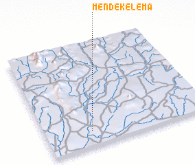 Places with similar names to Mendekelema, Sierra Leone ::
// Montcalm (US)
// Mount Calm (US)
// Montcalm (US)
// Montaguillaume (FR)
// Montcalm (FR)
// Mende Kelema (SL)
// Mendekelema (SL)
// Mendekelema (SL)
// Mendekelema (SL)
// Mendekelema (SL)
Disclaimer :: Information on this page comes without warranty of any kind |
||
|
Where is Mendekelema? Elevation and coordinates ::
Latitude (lat): 8°9'0"N Longitude (lon): 10°43'0"W
Elevation (approx.): 242m (map arrows pan, magnifying glasses zoom) |
||
|
Visiting Mendekelema? Hotel/Accommodation ::
Book a hotel in Mendekelema Travel Guide ::
rental cars ::
car rental offers GPS waypoint ::
download a GPX waypoint (PoI) of Mendekelema for your GPS receiver
|
||