|
search place name
|
||
Mirahun (Eastern, Sierra Leone)Mirahun is a town in the Eastern region of Sierra Leone. An overview map of the region around Mirahun is displayed below.
regional and 3d topo map of Mirahun, Sierra Leone ::

Mirahun airports ::
The nearest airport is MLW - Monrovia Spriggs Payne, located 191.1 km south of Mirahun.
Other airports nearby include ROB - Monrovia Roberts Intl (201.4 km south), Nearby towns ::
Tawi (1.9km south) //
Njala (2.3km south) //
Levuma (2.6km north east) //
Dablama (3.0km south east) //
Mobai (3.2km south west) //
Kotuma (3.7km east) //
Falaba (4.1km north east) //
Mandulawahun (4.1km north west) //
Pewama (4.1km south east) //
Baiima (4.1km north west) //
Kpeima (4.9km south east) //
Potolu (5.2km south west) //
Wunde (5.2km north east) //
Bonde (5.2km north west) //
Gorama (5.6km north) //
Mandoworo (5.9km south) //
Gahun (6.2km south) //
Giehun (6.6km north west) //
Manoworo (6.6km north east) //
Kangama (6.6km south east) //
Kambema (7.0km south east) //
Laoma (7.0km south) //
Tambiama (7.3km east) //
Go (7.6km south east) //
Siama (7.6km east) //
Gokoru (7.6km north) //
Sakiema (7.6km east) //
Magoma (7.8km north east) //
Maka (8.0km south east) //
[all distances 'as the bird flies' and approximate] 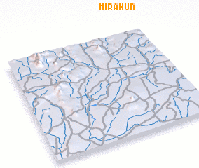 Places with similar names to Mirahun, Sierra Leone ::
Disclaimer :: Information on this page comes without warranty of any kind |
||
|
Where is Mirahun? Elevation and coordinates ::
Latitude (lat): 8°1'0"N Longitude (lon): 10°44'0"W
Elevation (approx.): 212m (map arrows pan, magnifying glasses zoom) |
||
|
Visiting Mirahun? Hotel/Accommodation ::
Book a hotel in Mirahun Travel Guide ::
rental cars ::
car rental offers GPS waypoint ::
download a GPX waypoint (PoI) of Mirahun for your GPS receiver
|
||