|
search place name
|
||
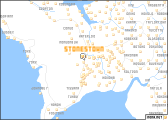
Stones Town (Western Area, Sierra Leone)Stones Town is a town in the Western Area region of Sierra Leone. An overview map of the region around Stones Town is displayed below.
regional and 3d topo map of Stones Town, Sierra Leone ::
Stones Town airports ::
The nearest airport is FNA - Freetown Lungi, located 37.2 km north of Stones Town.
Nearby towns ::
Middle Town (0.5km south) //
Samuel Town (0.9km north east) //
Jibima (1.3km north east) //
Sukuma Town (1.3km south) //
Koba (1.9km south west) //
Fakina (2.0km south east) //
Gendima (2.1km east) //
Jungalau (2.2km east) //
Macdonald (2.2km south) //
Ma-tindi (2.3km east) //
Binni (2.4km east) //
Benguema (2.4km north) //
Baponto (2.5km south east) //
Kakanda Town (2.9km north east) //
Hake Town (3.0km east) //
Bure Town (3.0km north east) //
Timmani Town (3.0km south east) //
Macdonald Wharf (3.1km south) //
Bassu Town (3.1km north east) //
Kani (3.1km south east) //
Cole Town (3.2km south) //
Campbell Town (3.3km east) //
New Fakai (3.3km south) //
Mary Wharf (3.5km south) //
Batbai (3.5km east) //
Irua (3.5km east) //
Kerry Town (3.5km south) //
Kossoh Town (3.6km north) //
Samahun (3.6km north west) //
[all distances 'as the bird flies' and approximate] 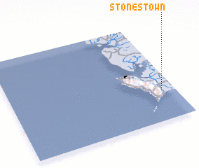 Places with similar names to Stones Town, Sierra Leone ::
// Stonestown (US)
Disclaimer :: Information on this page comes without warranty of any kind |
||
|
Where is Stones Town? Elevation and coordinates ::
Latitude (lat): 8°18'2"N Longitude (lon): 13°4'45"W
Elevation (approx.): 10m (map arrows pan, magnifying glasses zoom) |
||
|
Visiting Stones Town? Hotel/Accommodation ::
Book a hotel in Stones Town Travel Guide ::
rental cars ::
car rental offers GPS waypoint ::
download a GPX waypoint (PoI) of Stones Town for your GPS receiver
|
||