|
search place name
|
||
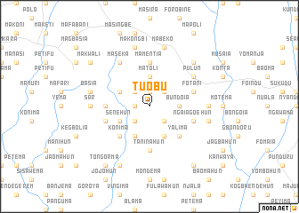
Tuobu (Eastern, Sierra Leone)Tuobu is a town in the Eastern region of Sierra Leone. An overview map of the region around Tuobu is displayed below.
regional and 3d topo map of Tuobu, Sierra Leone ::
Tuobu airports ::
The nearest airport is FAA - Faranah, located 179.7 km north east of Tuobu.
Other airports nearby include FNA - Freetown Lungi (194.1 km west), Nearby towns ::
Fotani (1.9km north) //
Mayola (1.8km west) //
Mayata (2.6km north east) //
Magbanapoli (2.6km north east) //
Heligohun (2.6km south east) //
Rosar (2.6km north west) //
Njorahun (2.6km south west) //
Bundoia (3.7km east) //
Matoli (3.7km north) //
Bondoma (4.1km south east) //
Gangama (4.1km south west) //
Petifu (4.1km north west) //
Senehun (4.1km south west) //
Yalima (5.2km south east) //
Konima (5.2km south west) //
Mamentia (5.6km north) //
Taninahun (5.6km south) //
Mabonka (5.5km west) //
Fotani (5.8km east) //
Ngaiagoehun (5.8km east) //
Pujehun (5.8km west) //
Pulun (6.6km north east) //
Maseka (6.7km north west) //
Makump (7.3km east) //
Sar (7.3km west) //
Bungema (7.6km east) //
Mabeko (7.6km north) //
Makongbi (7.6km north) //
Basia (7.6km west) //
[all distances 'as the bird flies' and approximate] 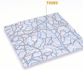 Places with similar names to Tuobu, Sierra Leone ::
Disclaimer :: Information on this page comes without warranty of any kind |
||
|
Where is Tuobu? Elevation and coordinates ::
Latitude (lat): 8°33'0"N Longitude (lon): 11°26'0"W
Elevation (approx.): 369m (map arrows pan, magnifying glasses zoom) |
||
|
Visiting Tuobu? Hotel/Accommodation ::
Book a hotel in Tuobu Travel Guide ::
rental cars ::
car rental offers GPS waypoint ::
download a GPX waypoint (PoI) of Tuobu for your GPS receiver
|
||