|
search place name
|
||
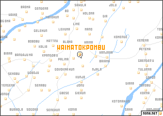
Waima Tokpombu (Eastern, Sierra Leone)Waima Tokpombu is a town in the Eastern region of Sierra Leone. An overview map of the region around Waima Tokpombu is displayed below.
regional and 3d topo map of Waima Tokpombu, Sierra Leone ::
Waima Tokpombu airports ::
The nearest airport is MLW - Monrovia Spriggs Payne, located 183.3 km south of Waima Tokpombu.
Other airports nearby include ROB - Monrovia Roberts Intl (207.5 km south east), FNA - Freetown Lungi (223.7 km north west), Nearby towns ::
Dandabu (1.8km west) //
Saama (1.9km south) //
Waima (3.1km north east) //
Serabu (3.3km east) //
Blama (3.9km north west) //
Palima (4.1km west) //
Govokpahun (5.2km south west) //
Njala (5.2km south east) //
Kunjo (5.6km south) //
Gbatawoma (5.8km west) //
Baiama (5.8km east) //
Mano (5.9km north) //
Wanjama (5.8km east) //
Levuma (6.7km north west) //
Komende (6.8km north east) //
Lime (6.9km north) //
Mattru (7.0km north west) //
Kpandobu (7.1km west) //
Tobanda (7.2km south west) //
Joru (7.4km south) //
Belu (7.6km west) //
Madina (8.2km west) //
Kalia (8.7km west) //
Dia (10.1km north east) //
Kundowahun (10.4km south west) //
Yovohun (10.5km north west) //
[all distances 'as the bird flies' and approximate] 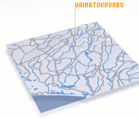 Places with similar names to Waima Tokpombu, Sierra Leone :: Disclaimer :: Information on this page comes without warranty of any kind |
||
|
Where is Waima Tokpombu? Elevation and coordinates ::
Latitude (lat): 7°51'0"N Longitude (lon): 11°19'0"W
Elevation (approx.): 130m (map arrows pan, magnifying glasses zoom) |
||
|
Visiting Waima Tokpombu? Hotel/Accommodation ::
Book a hotel in Waima Tokpombu Travel Guide ::
rental cars ::
car rental offers GPS waypoint ::
download a GPX waypoint (PoI) of Waima Tokpombu for your GPS receiver
|
||