|
search place name
|
||
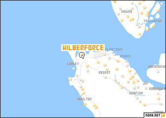
Wilberforce (Western Area, Sierra Leone)Wilberforce is a town in the Western Area region of Sierra Leone. An overview map of the region around Wilberforce is displayed below.
regional and 3d topo map of Wilberforce, Sierra Leone ::
Wilberforce airports ::
The nearest airport is FNA - Freetown Lungi, located 17.5 km north east of Wilberforce.
Other airports nearby include FIG - Fira Fria (210.3 km north), Nearby towns ::
Hill Station (1.9km south east) //
Murray Town (2.3km north) //
Mirimboe (2.9km south) //
Lumley (3.0km south west) //
Aberdeen (3.1km north west) //
New England (3.4km east) //
Freetown (3.8km north east) //
Pendembu (4.0km south) //
Fonima (4.8km south) //
Mount Aureol (4.9km east) //
Baoma (5.1km south) //
Leicester (5.1km east) //
Goderich (5.4km south west) //
Gloucester (5.8km south east) //
Kortright (5.9km east) //
Adonkia (6.3km south) //
Regent (6.5km south east) //
Angola Town (6.8km south) //
Cline Town (7.1km east) //
Fisher Lane (7.1km east) //
Ogue Farm (7.8km south) //
Kissy (7.8km east) //
Wellington Bassah (7.9km east) //
Lakka (8.2km south) //
Bathurst (8.6km south east) //
Bassa (9.5km south east) //
Charlotte (9.6km south east) //
Mortema (10.7km south east) //
Cotton Tree (12.3km north east) //
[all distances 'as the bird flies' and approximate] 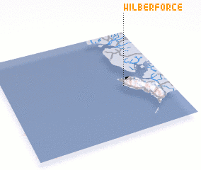 Places with similar names to Wilberforce, Sierra Leone ::
Disclaimer :: Information on this page comes without warranty of any kind |
||
|
Where is Wilberforce? Elevation and coordinates ::
Latitude (lat): 8°28'24"N Longitude (lon): 13°15'50"W
Elevation (approx.): 176m (map arrows pan, magnifying glasses zoom) |
||
|
Visiting Wilberforce? Hotel/Accommodation ::
Book a hotel in Wilberforce Travel Guide ::
rental cars ::
car rental offers GPS waypoint ::
download a GPX waypoint (PoI) of Wilberforce for your GPS receiver
|
||