|
search place name
|
||
Yandehun (Eastern, Sierra Leone)Yandehun is a town in the Eastern region of Sierra Leone. An overview map of the region around Yandehun is displayed below.
regional and 3d topo map of Yandehun, Sierra Leone ::

Yandehun airports ::
The nearest airport is FAA - Faranah, located 179.6 km north of Yandehun.
Nearby towns ::
Yendema (1.9km south) //
Yoabu (1.9km north) //
Komende (2.6km south east) //
Giema (3.7km south) //
Guala (3.7km south) //
Foindu (3.7km east) //
Pujehun (4.1km south east) //
Teoma (4.1km south west) //
Manjama (5.2km south west) //
Marima (5.6km south) //
Gondama (5.5km west) //
Naiagolehun (5.5km east) //
Bukuya (5.6km north) //
Sagbe (5.8km west) //
Jombohun (5.9km south) //
Walima (5.8km east) //
Petema (6.6km north west) //
Levuma (6.6km north east) //
Bandama (7.3km west) //
Wongoma (7.6km south) //
Vaama (7.6km south) //
Baidu (7.6km north) //
Fagoya (8.3km south east) //
Kangama (8.3km south west) //
Tokpombu (8.2km south west) //
Bandaru (8.2km north west) //
Silema (9.2km south west) //
Kogboma (9.2km south east) //
Guala (9.2km south east) //
[all distances 'as the bird flies' and approximate] 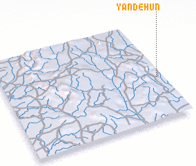 Places with similar names to Yandehun, Sierra Leone ::
// Yennádhion (GR)
// Yiannoúdhion (GR)
// Yandohun (LR)
// Yandahun (SL)
// Yandahun (SL)
// Yandehun (SL)
// Yandehun (SL)
// Yandihun (SL)
// Yandohun (SL)
// Yendehun (SL)
Disclaimer :: Information on this page comes without warranty of any kind |
||
|
Where is Yandehun? Elevation and coordinates ::
Latitude (lat): 8°26'0"N Longitude (lon): 11°2'0"W
Elevation (approx.): 494m (map arrows pan, magnifying glasses zoom) |
||
|
Visiting Yandehun? Hotel/Accommodation ::
Book a hotel in Yandehun Travel Guide ::
rental cars ::
car rental offers GPS waypoint ::
download a GPX waypoint (PoI) of Yandehun for your GPS receiver
|
||