|
search place name
|
||
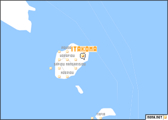
Itakoma ((( Épi )), Vanuatu)Itakoma is a town in the (( Épi )) region of Vanuatu. An overview map of the region around Itakoma is displayed below.
regional and 3d topo map of Itakoma, Vanuatu ::
Itakoma airports ::
The nearest airport is VLI - Port-vila Port Vila Bauerfield, located 92.8 km south of Itakoma.
Nearby towns ::
Éuta (1.8km west) //
Matangui-Salembanga (1.9km north) //
Mangarisiou (2.6km south west) //
Worafiou (3.5km west) //
Pourao (4.0km north west) //
Kouroumanpé (4.0km north west) //
Moériou (5.1km south west) //
Rafinga (5.3km west) //
Aiwos (5.3km west) //
Loupaléa (5.6km west) //
Safiou (5.6km west) //
Bongabonga (6.5km south west) //
Panita (7.3km west) //
Lamboukouti (7.3km west) //
[all distances 'as the bird flies' and approximate]  Places with similar names to Itakoma, Vanuatu ::
Disclaimer :: Information on this page comes without warranty of any kind |
||
|
Where is Itakoma? Elevation and coordinates ::
Latitude (lat): 16°54'0"S Longitude (lon): 168°35'0"E
Elevation (approx.): 65m (map arrows pan, magnifying glasses zoom) |
||
|
Visiting Itakoma? Hotel/Accommodation ::
Book a hotel in Itakoma Travel Guide ::
Buy a travel guide for Vanuatu rental cars ::
car rental offers GPS waypoint ::
download a GPX waypoint (PoI) of Itakoma for your GPS receiver
|
||