|
search place name
|
||
Lolimari ((( Aoba/Maéwo )), Vanuatu)Lolimari is a town in the (( Aoba/Maéwo )) region of Vanuatu. An overview map of the region around Lolimari is displayed below.
regional and 3d topo map of Lolimari, Vanuatu ::

Nearby towns ::
Lowounbouga (0.0km north) //
Waéling (0.0km north) //
Naïngama (1.8km west) //
Nangouèr (1.9km north) //
Arong (1.9km north) //
Evitawo (1.9km south) //
Lonbwélo (1.9km south) //
Lavonda (1.8km east) //
Bouéboué (1.8km east) //
Sarouaétan (2.6km south west) //
Lowountawor (2.6km north east) //
Lolsanga (3.7km south) //
Lowosi (4.1km south west) //
Saraerao (4.0km north west) //
Lowatoumbé (4.0km north east) //
Lolosori (5.1km north west) //
Mataravi (5.1km north east) //
Navonda (5.1km north east) //
Nagap (5.1km north east) //
Loldomaé (5.8km south) //
Lolomangoua (5.8km south) //
Lolovangé (6.5km north west) //
Abanga (6.5km north west) //
Lowitava (6.6km north west) //
Tavalavala (6.6km north west) //
Ambao (7.4km north) //
Alowou (7.4km north) //
Taémammavi (7.6km north) //
Lomatéïwéï (7.6km south) //
[all distances 'as the bird flies' and approximate] 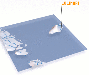 Places with similar names to Lolimari, Vanuatu ::
// Lilymoor (US)
// Lalimere (US)
// La Llamera (ES)
// Lalamara (TD)
// Lola María (EC)
// Lelemuri (ID)
// Lolomerui (ID)
// La Lumbre (MX)
// La Lumbre (MX)
// Lulemera (TZ)
Disclaimer :: Information on this page comes without warranty of any kind |
||
|
Where is Lolimari? Elevation and coordinates ::
Latitude (lat): 15°21'0"S Longitude (lon): 167°56'0"E
Elevation (approx.): 143m (map arrows pan, magnifying glasses zoom) |
||
|
Visiting Lolimari? Hotel/Accommodation ::
Book a hotel in Lolimari Travel Guide ::
Buy a travel guide for Vanuatu rental cars ::
car rental offers GPS waypoint ::
download a GPX waypoint (PoI) of Lolimari for your GPS receiver
|
||