|
search place name
|
||
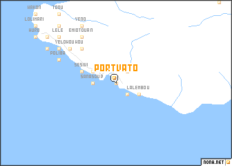
Port-Vato ((( Ambrym )), Vanuatu)Port-Vato is a town in the (( Ambrym )) region of Vanuatu. An overview map of the region around Port-Vato is displayed below.
regional and 3d topo map of Port-Vato, Vanuatu ::
Port-Vato airports ::
The nearest airport is VLI - Port-vila Port Vila Bauerfield, located 154.2 km south of Port-Vato.
Nearby towns ::
Lononwei (0.0km north) //
Pesia (2.6km north east) //
Lalinda (2.6km south east) //
Emiotébin (3.6km west) //
Sanasoup (3.6km west) //
Meltébin (4.0km north west) //
Bolès (4.0km south east) //
Lalembou (4.0km south east) //
Sésivi (5.6km west) //
Aoutili (7.7km north west) //
Mapkinkin (7.7km north west) //
Emiotouan (9.1km north west) //
Yélowouwou (9.0km north west) //
[all distances 'as the bird flies' and approximate] 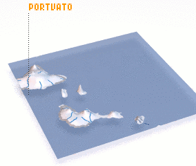 Places with similar names to Port-Vato, Vanuatu ::
// Pôrto Veado (BR)
// Pīr Dāvūd (IR)
// Portofita (GN)
// Puerto Vita (CU)
// Purti Ghāt (NP)
// Portavadie (GB)
Disclaimer :: Information on this page comes without warranty of any kind |
||
|
Where is Port-Vato? Elevation and coordinates ::
Latitude (lat): 16°20'0"S Longitude (lon): 168°2'0"E
Elevation (approx.): -32768m (map arrows pan, magnifying glasses zoom) |
||
|
Visiting Port-Vato? Hotel/Accommodation ::
Book a hotel in Port-Vato Travel Guide ::
Buy a travel guide for Vanuatu rental cars ::
car rental offers GPS waypoint ::
download a GPX waypoint (PoI) of Port-Vato for your GPS receiver
|
||