|
search place name
|
||
Térou (Sanma, Vanuatu)Térou is a town in the Sanma region of Vanuatu. An overview map of the region around Térou is displayed below.
regional and 3d topo map of Térou, Vanuatu ::
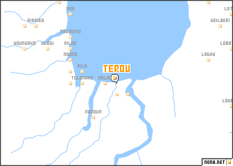
Nearby towns ::
Poétsaysay (1.9km south) //
Talatas (1.9km south) //
Malao (1.8km west) //
Worovok (2.6km south east) //
Tolomako (5.4km west) //
Pila (5.7km west) //
Orota (5.7km west) //
Navoun (6.6km south west) //
Maé (7.2km west) //
Atsaritibi (7.4km west) //
Naano (8.1km north west) //
Maloéta (8.1km north west) //
Piloé (9.1km north west) //
Tsuréviu (10.3km north west) //
[all distances 'as the bird flies' and approximate] 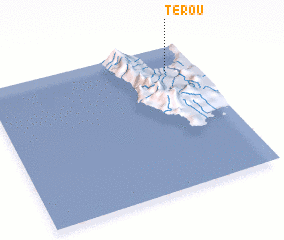 Places with similar names to Térou, Vanuatu ::
Disclaimer :: Information on this page comes without warranty of any kind |
||
|
Where is Térou? Elevation and coordinates ::
Latitude (lat): 15°10'0"S Longitude (lon): 166°52'0"E
Elevation (approx.): -32768m (map arrows pan, magnifying glasses zoom) |
||
|
Visiting Térou? Hotel/Accommodation ::
Book a hotel in Térou Travel Guide ::
Buy a travel guide for Vanuatu rental cars ::
car rental offers GPS waypoint ::
download a GPX waypoint (PoI) of Térou for your GPS receiver
|
||