|
search place name
|
||
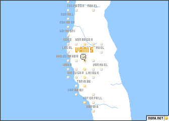
Vanis ((( Pentecôte )), Vanuatu)Vanis is a town in the (( Pentecôte )) region of Vanuatu. An overview map of the region around Vanis is displayed below.
regional and 3d topo map of Vanis, Vanuatu ::
Vanis airports ::
The nearest airport is VLI - Port-vila Port Vila Bauerfield, located 222.0 km south of Vanis.
Nearby towns ::
Lerasangoul (0.0km north) //
Wadovaga (1.9km south) //
Laravinambosvi (1.9km north) //
Métarouk (1.9km south) //
Enkoul (1.8km east) //
Nokombilatata (1.8km west) //
Nokokoul (1.8km west) //
Lératowo (1.8km west) //
Léboukouvini (1.8km west) //
Wadounbowi (1.8km west) //
Lémalda (2.6km south east) //
Tosi (2.6km north west) //
Sasanadam (2.6km south west) //
Lémèmbléké (2.6km north east) //
Léboutsousap (2.6km south west) //
Houbikou (2.6km south west) //
Vatowasis (2.6km south west) //
Goun (2.6km south west) //
Lalda (2.6km south east) //
Lewaïbilak (2.6km north west) //
Leboung (2.6km north west) //
Lével (2.6km north east) //
Lédavi (2.6km south east) //
Barksal (2.6km south east) //
Léwawa (2.6km south east) //
Lésasa (2.6km north east) //
Narouah (2.6km north east) //
Koulbaga (2.6km north west) //
Baga (2.6km south west) //
[all distances 'as the bird flies' and approximate] 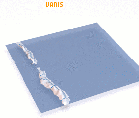 Places with similar names to Vanis, Vanuatu ::
Disclaimer :: Information on this page comes without warranty of any kind |
||
|
Where is Vanis? Elevation and coordinates ::
Latitude (lat): 15°42'0"S Longitude (lon): 168°9'0"E
Elevation (approx.): 398m (map arrows pan, magnifying glasses zoom) |
||
|
Visiting Vanis? Hotel/Accommodation ::
Book a hotel in Vanis Travel Guide ::
Buy a travel guide for Vanuatu rental cars ::
car rental offers GPS waypoint ::
download a GPX waypoint (PoI) of Vanis for your GPS receiver
|
||