|
search place name
|
||
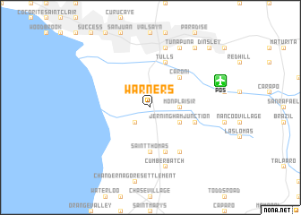
Warners (Caroni, Trinidad and Tobago)Warners is a town in the Caroni region of Trinidad and Tobago. An overview map of the region around Warners is displayed below.
regional and 3d topo map of Warners, Trinidad and Tobago ::
Warners airports ::
The nearest airport is POS - Port-of-spain Piarco, located 9.3 km east of Warners.
Other airports nearby include TAB - Scarborough Crown Point (90.8 km north east), GUI - Guiria (98.1 km west), GND - Point Salines Intl (164.1 km north), TUV - Tucupita (179.5 km south west), Nearby towns ::
Cacandee Settlement (2.6km south west) //
Warren (2.6km north east) //
Mon Plaisir (3.6km east) //
Jerningham Junction (4.1km south east) //
Caroni (5.2km north east) //
Saint Thomas (5.6km south) //
Chaguanas (5.6km south) //
Cunupia (5.8km east) //
Tulls (5.9km north) //
Lendor (5.9km south) //
Longdenville (6.6km south east) //
Curepe (7.6km north) //
Cumberbatch (7.6km south) //
El Dorado (8.3km north east) //
Tunapuna (8.3km north east) //
Tacarigua (9.2km north east) //
Dinsley (10.4km north east) //
[all distances 'as the bird flies' and approximate] 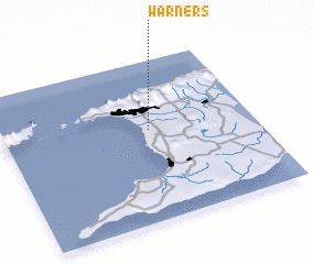 Places with similar names to Warners, Trinidad and Tobago ::
Disclaimer :: Information on this page comes without warranty of any kind |
||
|
Where is Warners? Elevation and coordinates ::
Latitude (lat): 10°34'0"N Longitude (lon): 61°25'0"W
Elevation (approx.): 8m (map arrows pan, magnifying glasses zoom) |
||
|
Visiting Warners? Hotel/Accommodation ::
Book a hotel in Warners Travel Guide ::
rental cars ::
car rental offers GPS waypoint ::
download a GPX waypoint (PoI) of Warners for your GPS receiver
|
||