|
search place name
|
||
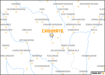
Chidumayo (Malawi)Chidumayo is a town in Malawi. An overview map of the region around Chidumayo is displayed below.
regional and 3d topo map of Chidumayo, Malawi ::
Chidumayo airports ::
The nearest airport is ZZU - Mzuzu, located 49.5 km east of Chidumayo.
Other airports nearby include KGJ - Karonga (178.4 km north), MFU - Mfuwe (260.5 km south west), VXC - Lichinga (266.9 km south east), Nearby towns ::
Kazithule Ziwa (1.8km east) //
Magodi Nyirenda (1.9km south) //
Chidumayo Nguruwe (3.7km north) //
Gowoka Nyanguru (4.1km north east) //
Robert Luwe (5.2km south east) //
Jalani Kaunda (5.8km south) //
Mchinga Sanga (6.6km north west) //
Robert Thupa (6.6km south east) //
Mzalangwe (7.4km south) //
Hanock Ngwira (7.4km south) //
Mkwakwazu (7.5km east) //
Kamuwanga (7.8km north west) //
Ephandeni Ziwa (8.2km north east) //
Jandalala (9.1km south east) //
Scott Mhango (9.2km north east) //
Kumwenda (9.2km south west) //
Kafukule (10.4km north east) //
[all distances 'as the bird flies' and approximate] 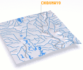
Disclaimer :: Information on this page comes without warranty of any kind |
||
|
Where is Chidumayo? Elevation and coordinates ::
Latitude (lat): 11°32'0"S Longitude (lon): 33°34'0"E
Elevation (approx.): 1347m (map arrows pan, magnifying glasses zoom) |
||
|
Visiting Chidumayo? Hotel/Accommodation ::
Book a hotel in Chidumayo Travel Guide ::
Buy a travel guide for Malawi rental cars ::
car rental offers GPS waypoint ::
download a GPX waypoint (PoI) of Chidumayo for your GPS receiver
|
||