|
search place name
|
||
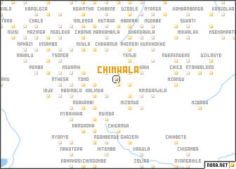
Chimwala (Malawi)Chimwala is a town in Malawi. An overview map of the region around Chimwala is displayed below.
regional and 3d topo map of Chimwala, Malawi ::
Chimwala airports ::
The nearest airport is LLW - Lilongwe Kamuzu Intl, located 37.7 km south west of Chimwala.
Other airports nearby include VXC - Lichinga (146.2 km east), MFU - Mfuwe (217.7 km west), Nearby towns ::
Dalien (0.0km north) //
Mbia (1.9km north) //
Chikwawe (1.8km east) //
Chinweza (2.6km north west) //
Mimba (2.6km north west) //
Kwangala (2.6km south west) //
Nalimba (2.6km south west) //
Bisa (2.6km north east) //
Mupine (2.6km south east) //
Kisoso (3.6km west) //
Tenje (4.1km north east) //
Jere (4.1km north east) //
Bande (4.1km north east) //
Kalinda (4.1km south west) //
Chisambi (4.1km north east) //
Mkwawi (4.1km north east) //
Mizonda (4.1km south east) //
Benga (4.1km south east) //
Mizondo (4.1km south east) //
Msungwi (5.2km south west) //
Kashele (5.2km south east) //
Tomo (5.4km west) //
Jisoso (5.4km west) //
Ndinda (5.8km south) //
Chawanda (5.8km north) //
Dumea (5.7km west) //
Mpinganjila (5.7km east) //
Phereni (5.8km north) //
Kanyama (6.6km north east) //
[all distances 'as the bird flies' and approximate] 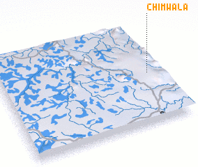 Places with similar names to Chimwala, Malawi ::
// Chamwela (ZM)
// Chimbwala (ZM)
// Chimwala (ZM)
// Chimwala (ZM)
// Chimwala (ZM)
// Chimwele (ZM)
// Shamwalie (ZM)
// Shombwila (ZM)
// Chāh Māiwāla (PK)
// Chambawāla (PK)
Disclaimer :: Information on this page comes without warranty of any kind |
||
|
Where is Chimwala? Elevation and coordinates ::
Latitude (lat): 13°29'0"S Longitude (lon): 33°56'0"E
Elevation (approx.): 1396m (map arrows pan, magnifying glasses zoom) |
||
|
Visiting Chimwala? Hotel/Accommodation ::
Book a hotel in Chimwala Travel Guide ::
Buy a travel guide for Malawi rental cars ::
car rental offers GPS waypoint ::
download a GPX waypoint (PoI) of Chimwala for your GPS receiver
|
||