|
search place name
|
||
Cimcira (Malawi)Cimcira is a town in Malawi. An overview map of the region around Cimcira is displayed below.
regional and 3d topo map of Cimcira, Malawi ::

Cimcira airports ::
The nearest airport is LLW - Lilongwe Kamuzu Intl, located 33.3 km south east of Cimcira.
Other airports nearby include MFU - Mfuwe (175.2 km west), VXC - Lichinga (196.1 km east), Nearby towns ::
Kayembe (0.0km north) //
Chilonga (1.8km east) //
Malanda (1.8km east) //
Mondwe (1.8km east) //
Kalumbe (2.6km south west) //
Mbangala (2.6km north west) //
Chatanga (2.6km north east) //
Sandulizeni (3.7km south) //
Phenjele (3.6km east) //
Tsicipapa (3.6km east) //
Mtuzi (3.6km east) //
Mangadz (3.6km east) //
Napwenje (3.6km west) //
Mchoka (3.6km east) //
Mtaya (3.7km north) //
Kancele (4.1km south east) //
Mphepho (4.1km south west) //
Khulumuniyu (4.1km south west) //
Mpaya (4.1km south west) //
Mzowa (4.1km south east) //
Kancence (4.1km south east) //
Mwasala (4.1km north west) //
Chimptsolo (4.1km north east) //
Chimambo (4.1km north west) //
Chankakhala (4.1km north east) //
Kancele (5.2km south east) //
Chimzu (5.2km south west) //
Chinsunche (5.2km south west) //
Nyonbawi (5.4km east) //
[all distances 'as the bird flies' and approximate] 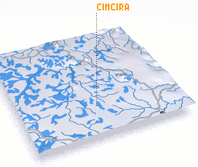 Places with similar names to Cimcira, Malawi ::
// Sumozero (RU)
// Symbozero (RU)
// Zamzor (RU)
// Siimusaare (EE)
// Sumsare (ZA)
// Semmbouassaré (BJ)
// Samesra (IN)
// Cimasri (ID)
// Semisir (ID)
// Cimsari (MX)
Disclaimer :: Information on this page comes without warranty of any kind |
||
|
Where is Cimcira? Elevation and coordinates ::
Latitude (lat): 13°40'0"S Longitude (lon): 33°30'0"E
Elevation (approx.): 1113m (map arrows pan, magnifying glasses zoom) |
||
|
Visiting Cimcira? Hotel/Accommodation ::
Book a hotel in Cimcira Travel Guide ::
Buy a travel guide for Malawi rental cars ::
car rental offers GPS waypoint ::
download a GPX waypoint (PoI) of Cimcira for your GPS receiver
|
||