|
search place name
|
||
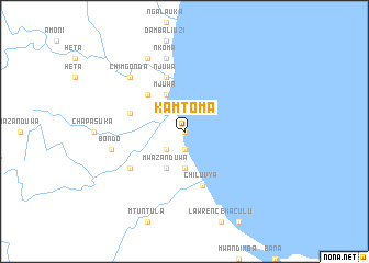
Kamtoma (Malawi)Kamtoma is a town in Malawi. An overview map of the region around Kamtoma is displayed below.
regional and 3d topo map of Kamtoma, Malawi ::
Kamtoma airports ::
The nearest airport is ZZU - Mzuzu, located 92.8 km north of Kamtoma.
Other airports nearby include LLW - Lilongwe Kamuzu Intl (168.8 km south), VXC - Lichinga (173.0 km south east), Nearby towns ::
Chigadula (0.0km north) //
Kamphandila (0.0km north) //
Phulos Nyaluanga (1.9km south) //
Kafuzila (1.9km south) //
Mzoza (1.9km south) //
Kanyamngondo (2.6km north west) //
Mbiwi (2.6km north west) //
Bondo (2.6km south west) //
Kaswaya (3.7km south) //
Mjuwa (4.1km north west) //
Malamba (4.1km north west) //
Chimweyo (4.1km north west) //
Mwazanduwa (4.1km south west) //
Chimgonda (5.2km north west) //
Njuwa (5.8km north) //
Kazando (5.8km north) //
Kamphambale (5.7km west) //
Chiluvya (5.8km south) //
Cendesula (6.6km south west) //
Nkoma (7.6km north) //
Bondo (7.5km west) //
Chimgonda (7.8km north west) //
Chimgonda (8.3km north west) //
[all distances 'as the bird flies' and approximate]  Places with similar names to Kamtoma, Malawi ::
// Goi-Matemo (CD)
// Kamduma (CD)
// Kamitumbi (CD)
// Kombitoumba (GA)
// Guimba Tombo (NE)
// Koumbadiouma (SN)
// Kamtambe (ZM)
// Kamtimbo (TZ)
// Koumbatamba (GN)
// Kamatami (PG)
Disclaimer :: Information on this page comes without warranty of any kind |
||
|
Where is Kamtoma? Elevation and coordinates ::
Latitude (lat): 12°17'0"S Longitude (lon): 34°2'0"E
Elevation (approx.): 476m (map arrows pan, magnifying glasses zoom) |
||
|
Visiting Kamtoma? Hotel/Accommodation ::
Book a hotel in Kamtoma Travel Guide ::
Buy a travel guide for Malawi rental cars ::
car rental offers GPS waypoint ::
download a GPX waypoint (PoI) of Kamtoma for your GPS receiver
|
||