|
search place name
|
||
Kankhomba (Malawi)Kankhomba is a town in Malawi. An overview map of the region around Kankhomba is displayed below.
regional and 3d topo map of Kankhomba, Malawi ::

Kankhomba airports ::
The nearest airport is BLZ - Blantyre Chileka Intl, located 47.6 km south west of Kankhomba.
Other airports nearby include TET - Tete Chingodzi (197.0 km west), LLW - Lilongwe Kamuzu Intl (249.7 km north west), Nearby towns ::
James (0.0km north) //
Chikumbu (1.9km south) //
Thomas Matopa (1.9km south) //
Chipanda (1.8km east) //
Nakhwala (2.6km south east) //
Kungauma (2.6km north west) //
Sonkho (2.6km south east) //
Mwamafumu (3.6km east) //
Umi (3.7km north) //
Balakasi (3.7km south) //
Makanjira (3.6km west) //
Macmaurice (4.0km north east) //
Songo (4.1km north west) //
Chilombo (4.1km south west) //
Mwenyali (4.1km south east) //
Nachuma (4.1km south east) //
Nambesa (5.1km north east) //
Salimukanga (5.1km south east) //
Kuntemba (5.1km south east) //
Mpakati (5.1km north west) //
Kungauma (5.1km north west) //
Chidyaonga (5.1km south west) //
Selemani (5.1km south west) //
Manolo (5.1km south west) //
Tom Allen (5.6km north) //
Mpota (5.6km north) //
Ntala (5.8km north) //
Mainuka (5.8km north) //
Kasembe (5.8km north) //
[all distances 'as the bird flies' and approximate] 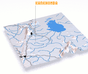 Places with similar names to Kankhomba, Malawi ::
Disclaimer :: Information on this page comes without warranty of any kind |
||
|
Where is Kankhomba? Elevation and coordinates ::
Latitude (lat): 15°27'0"S Longitude (lon): 35°21'0"E
Elevation (approx.): 822m (map arrows pan, magnifying glasses zoom) |
||
|
Visiting Kankhomba? Hotel/Accommodation ::
Book a hotel in Kankhomba Travel Guide ::
Buy a travel guide for Malawi rental cars ::
car rental offers GPS waypoint ::
download a GPX waypoint (PoI) of Kankhomba for your GPS receiver
|
||