|
search place name
|
||
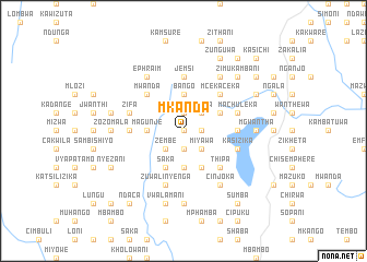
Mkanda (Malawi)Mkanda is a town in Malawi. An overview map of the region around Mkanda is displayed below.
regional and 3d topo map of Mkanda, Malawi ::
Mkanda airports ::
The nearest airport is LLW - Lilongwe Kamuzu Intl, located 139.1 km south of Mkanda.
Other airports nearby include ZZU - Mzuzu (141.6 km north east), MFU - Mfuwe (177.2 km south west), VXC - Lichinga (214.8 km east), Nearby towns ::
Luziwa (0.0km north) //
Sitima (0.0km north) //
Kalimadola (1.9km north) //
Cikanakuva (1.9km north) //
Mwanyota (1.9km north) //
Mphosa (1.9km north) //
Vyauka (1.8km east) //
Kanyinji (1.9km south) //
Kanitute (1.9km south) //
Mauya (2.6km north east) //
Wilima (2.6km north east) //
Lungu (2.6km north east) //
Katuwa (2.6km south east) //
Miyawa (2.6km south east) //
Zembe (2.6km south west) //
Bokosi (2.6km south west) //
Ngalamila (2.6km south west) //
Bango (3.7km north) //
Chimzinga (3.7km north) //
Mkondambiri (3.7km south) //
Magunje (3.6km west) //
Sitolo (4.1km north east) //
Alamu (4.1km north east) //
Kadosola (4.1km south east) //
Myayi (4.1km south west) //
Saka (4.1km south west) //
Mcekaceka (5.2km north east) //
Thipa (5.2km south east) //
Bechani (5.2km north west) //
[all distances 'as the bird flies' and approximate] 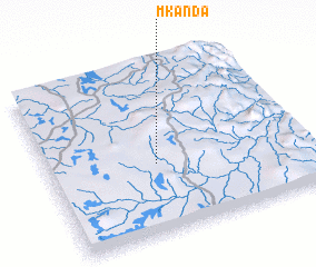 Places with similar names to Mkanda, Malawi ::
Disclaimer :: Information on this page comes without warranty of any kind |
||
|
Where is Mkanda? Elevation and coordinates ::
Latitude (lat): 12°35'0"S Longitude (lon): 33°25'0"E
Elevation (approx.): 1232m (map arrows pan, magnifying glasses zoom) |
||
|
Visiting Mkanda? Hotel/Accommodation ::
Book a hotel in Mkanda Travel Guide ::
Buy a travel guide for Malawi rental cars ::
car rental offers GPS waypoint ::
download a GPX waypoint (PoI) of Mkanda for your GPS receiver
|
||