|
search place name
|
||
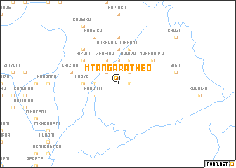
Mtangara Theo (Malawi)Mtangara Theo is a town in Malawi. An overview map of the region around Mtangara Theo is displayed below.
regional and 3d topo map of Mtangara Theo, Malawi ::
Mtangara Theo airports ::
The nearest airport is ZZU - Mzuzu, located 116.2 km north of Mtangara Theo.
Other airports nearby include LLW - Lilongwe Kamuzu Intl (146.3 km south), VXC - Lichinga (185.7 km south east), MFU - Mfuwe (217.1 km south west), Nearby towns ::
Kabiri (1.8km east) //
Njakwa (1.8km east) //
Kanyinji (2.6km north east) //
Makopala Hara (2.6km north west) //
Gwazeni (3.7km north) //
Miti (3.6km west) //
Mapira (4.1km north east) //
Kampoti (4.1km south west) //
Zebedia (4.1km north west) //
Makhuwila Nkhoma (5.6km north) //
Mwaya (5.4km west) //
Khosolo Jere (5.8km north) //
Makhuwira (6.6km north east) //
Chizani (6.6km north west) //
Chilawo Banda (7.4km north) //
Chizani (7.5km west) //
Kapindula (7.8km north west) //
Kausiku (8.2km north west) //
[all distances 'as the bird flies' and approximate] 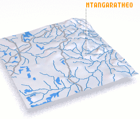 Places with similar names to Mtangara Theo, Malawi :: Disclaimer :: Information on this page comes without warranty of any kind |
||
|
Where is Mtangara Theo? Elevation and coordinates ::
Latitude (lat): 12°28'0"S Longitude (lon): 33°46'0"E
Elevation (approx.): 1218m (map arrows pan, magnifying glasses zoom) |
||
|
Visiting Mtangara Theo? Hotel/Accommodation ::
Book a hotel in Mtangara Theo Travel Guide ::
Buy a travel guide for Malawi rental cars ::
car rental offers GPS waypoint ::
download a GPX waypoint (PoI) of Mtangara Theo for your GPS receiver
|
||