|
search place name
|
||
Ndebvu (Malawi)Ndebvu is a town in Malawi. An overview map of the region around Ndebvu is displayed below.
regional and 3d topo map of Ndebvu, Malawi ::

Ndebvu airports ::
The nearest airport is LLW - Lilongwe Kamuzu Intl, located 46.7 km north east of Ndebvu.
Other airports nearby include MFU - Mfuwe (180.8 km north west), VXC - Lichinga (216.3 km east), BLZ - Blantyre Chileka Intl (248.8 km south east), Nearby towns ::
Mtali (1.9km north) //
Nkwambala (1.8km west) //
Chileka (1.8km west) //
Nthondo (2.6km south east) //
Khanda (3.6km east) //
Likongwe (3.7km north) //
Jalusa (4.1km south east) //
Moses (4.1km south west) //
Mtika (4.1km south west) //
Mpingo (4.0km north east) //
Mzindo (4.1km north east) //
Kalolo (4.0km north west) //
Matundaludzi (5.2km south east) //
Tondoloza (5.2km south east) //
Muyala (5.2km north east) //
Cikazamoto (5.2km south west) //
Kamangira (5.2km north west) //
Kandaya (5.6km south) //
Chinkuyu (5.6km south) //
Madzi (5.7km east) //
Masekezi (5.7km west) //
Zowde (5.8km south) //
Songoli (5.8km north) //
Katakungwa (5.7km east) //
Nsipo (5.8km south) //
Chikuzulire (5.8km north) //
Kasenza (6.5km south west) //
Chibungu (6.6km north east) //
Ngongonda (6.5km north east) //
[all distances 'as the bird flies' and approximate] 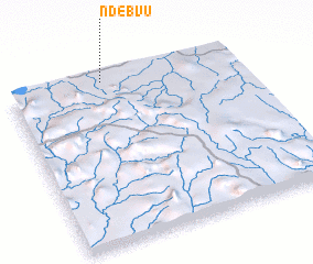 Places with similar names to Ndebvu, Malawi ::
// Ndebvu (MW)
Disclaimer :: Information on this page comes without warranty of any kind |
||
|
Where is Ndebvu? Elevation and coordinates ::
Latitude (lat): 14°1'0"S Longitude (lon): 33°25'0"E
Elevation (approx.): 1178m (map arrows pan, magnifying glasses zoom) |
||
|
Visiting Ndebvu? Hotel/Accommodation ::
Book a hotel in Ndebvu Travel Guide ::
Buy a travel guide for Malawi rental cars ::
car rental offers GPS waypoint ::
download a GPX waypoint (PoI) of Ndebvu for your GPS receiver
|
||