|
search place name
|
||
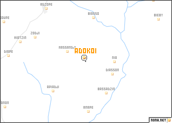
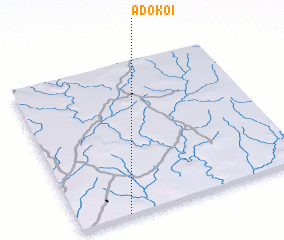
Adokoi (Cote d'Ivoire)Adokoi is a town in Cote d'Ivoire. An overview map of the region around Adokoi is displayed below.
regional and 3d topo map of Adokoi, Cote d'Ivoire ::
Adokoi airports ::
The nearest airport is ABJ - Abidjan Felix Houphouet Boigny Intl, located 83.5 km south of Adokoi.
Other airports nearby include ASK - Yamoussoukro (201.3 km north west), NYI - Sunyani (220.2 km north east), BYK - Bouake (239.1 km north west), Nearby towns ::
 Places with similar names to Adokoi, Cote d'Ivoire ::
Disclaimer :: Information on this page comes without warranty of any kind |
||
|
Where is Adokoi? Elevation and coordinates ::
Latitude (lat): 6°0'10"N Longitude (lon): 3°47'2"W
Elevation (approx.): 96m (map arrows pan, magnifying glasses zoom) |
||
|
Visiting Adokoi? Hotel/Accommodation ::
Book a hotel in Adokoi Travel Guide ::
rental cars ::
car rental offers GPS waypoint ::
download a GPX waypoint (PoI) of Adokoi for your GPS receiver
|
||