|
search place name
|
||
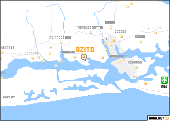
Azito (Cote d'Ivoire)Azito is a town in Cote d'Ivoire. An overview map of the region around Azito is displayed below.
regional and 3d topo map of Azito, Cote d'Ivoire ::
Azito airports ::
The nearest airport is ABJ - Abidjan Felix Houphouet Boigny Intl, located 18.1 km east of Azito.
Other airports nearby include ASK - Yamoussoukro (226.9 km north west), Nearby towns ::
Yopougon-Kouté (2.3km north east) //
Niangon-Lokoa (2.4km west) //
Yopougon-Santé (3.9km east) //
Locodjo (5.2km north east) //
Abadjin-Doumé (5.4km west) //
Santé (5.8km north east) //
Abobo Doumé (5.9km east) //
Plateau (5.9km east) //
Yopougon-Attié (6.4km north) //
Audoin (6.5km west) //
Adiapo-Doumé (6.6km north west) //
Williamsville (6.7km north east) //
Anoumabo (7.5km east) //
Abidjan (7.7km north east) //
Bimbresso (7.9km west) //
Abadjin-Kouté (8.2km west) //
Adjamé (8.4km north east) //
Treichville (8.4km east) //
Agban (9.2km north east) //
Cocody (9.7km north east) //
[all distances 'as the bird flies' and approximate] 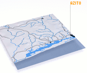 Places with similar names to Azito, Cote d'Ivoire ::
Disclaimer :: Information on this page comes without warranty of any kind |
||
|
Where is Azito? Elevation and coordinates ::
Latitude (lat): 5°18'5"N Longitude (lon): 4°5'5"W
Elevation (approx.): 1m (map arrows pan, magnifying glasses zoom) |
||
|
Visiting Azito? Hotel/Accommodation ::
Book a hotel in Azito Travel Guide ::
rental cars ::
car rental offers GPS waypoint ::
download a GPX waypoint (PoI) of Azito for your GPS receiver
|
||