|
search place name
|
||
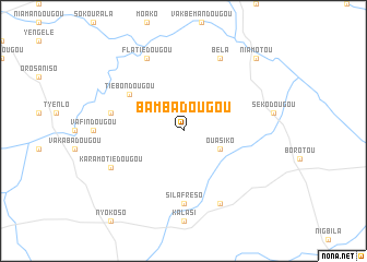
Bambadougou (Cote d'Ivoire)Bambadougou is a town in Cote d'Ivoire. An overview map of the region around Bambadougou is displayed below.
regional and 3d topo map of Bambadougou, Cote d'Ivoire ::
Bambadougou airports ::
The nearest airport is MJC - Man, located 165.3 km south of Bambadougou.
Other airports nearby include DJO - Daloa (251.2 km south east), Nearby towns ::
Ouasiko (4.1km south east) //
Tiebondougou (6.6km north west) //
Silafréso (7.4km south) //
Mémadougou-Sokourala (7.6km west) //
Béla (8.3km north east) //
Flatiédougou (8.3km north west) //
Moyendougou (8.3km south east) //
Karamotiédougou (8.2km south west) //
Niamotou (10.4km north east) //
[all distances 'as the bird flies' and approximate] 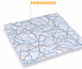 Places with similar names to Bambadougou, Cote d'Ivoire ::
// Bumitog (PH)
// Bemetaka (MG)
// Bembé Ouadaka (CF)
// Bomba de Agua (CO)
// Bammbatuk (SL)
// Bomotoke (SL)
// Bamba Digua (ML)
Disclaimer :: Information on this page comes without warranty of any kind |
||
|
Where is Bambadougou? Elevation and coordinates ::
Latitude (lat): 8°46'0"N Longitude (lon): 7°36'0"W
Elevation (approx.): 452m (map arrows pan, magnifying glasses zoom) |
||
|
Visiting Bambadougou? Hotel/Accommodation ::
Book a hotel in Bambadougou Travel Guide ::
rental cars ::
car rental offers GPS waypoint ::
download a GPX waypoint (PoI) of Bambadougou for your GPS receiver
|
||